Area Overview for BD9 6PS
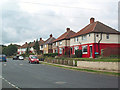
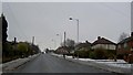
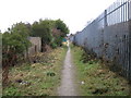
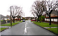
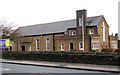
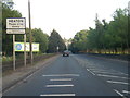
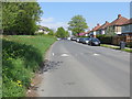
Photos of BD9 6PS
Area Information
Living in BD9 6PS means residing within a specific residential cluster of the Heaton Ward in Bradford. This postcode covers a small footprint of 3,436 square metres yet supports a population of 2,231 people. The area sits at a high population density of 2,134 people per square kilometre, creating an environment where neighbours are proximate and community life moves at a brisker pace. Historically, this locality traces back to the villages of Frizinghall and Daisy Hill, areas that were distinct civil parishes before merging into Bradford in 1898. Residents today inhabit properties that blend with the ward's heritage, which includes historic street layouts and conservation areas dating back to the 19th century. The location benefits from proximity to Heaton Hall and the former Woolsorters' Gardens, giving the residential cluster a layered history. While the land is small in total square metres, the concentration of homes creates a tight-knit neighbourhood feel. You will find yourself in a part of West Yorkshire that balances historical significance with modern density. Daily life involves navigating a close-quarters community where the history of the Anglo-Saxon 'high farmstead' influences the current rhythm of the ward. The area remains rooted in its identity as a traditional residential zone within the City of Bradford metropolitan borough.
- Area Type
- Postcode
- Area Size
- 3436 m²
- Population
- 2231
- Population Density
- 2134 people/km²
The property market in BD9 6PS is characterised by a stable share of owner-occupied residences accounting for 74% of the homes. The remaining 26% represents a mixture of rental properties and possibly shared ownership schemes. The primary accommodation type consists of houses, which are the standard dwelling form throughout the Heaton Ward. This prevalence of houses suggests that buyers looking for this postal code will find single-family homes and semi-detached properties rather than high-rise blocks or purpose-built flats. Given the small land area of 3,436 square metres, the housing stock is compact within its boundaries yet extends into the wider residential fabric of the ward. You should expect to deal with properties that may have undergone modifications over time, given the ward's long history of occupation since the late 16th century. The high ownership percentage means most listings will be from existing owners seeking to move rather than from new build developers. This dynamic typically results in a market where established values guide pricing trends. Buyers looking at homes in BD9 6PS are purchasing into a legacy area with deep roots in the local housing supply chain.
House Prices in BD9 6PS
Showing 7 properties
| Address | Type | Beds | Baths | Last Sale Price | Last Sale Date | |
|---|---|---|---|---|---|---|
| 10 Brantwood Avenue, Bradford, BD9 6PS | Semi-detached | 2 | 1 | £140,000 | Apr 2023 | |
| 4 Brantwood Avenue, Bradford, BD9 6PS | Bungalow | - | - | £135,000 | Jul 2022 | |
| 2 Brantwood Avenue, Bradford, BD9 6PS | house | 3 | - | £155,000 | Feb 2007 | |
| 8 Brantwood Avenue, Bradford, BD9 6PS | Bungalow | - | - | £92,500 | Nov 2004 | |
| 3 Brantwood Avenue, Bradford, BD9 6PS | house | - | - | £105,000 | Nov 2004 | |
| 6 Brantwood Avenue, Bradford, BD9 6PS | Semi-detached | - | - | £39,000 | Nov 1995 | |
| 1 Brantwood Avenue, Bradford, BD9 6PS | Land | 3 | 1 | - | - |
Energy Efficiency in BD9 6PS
Daily life in BD9 6PS is supported by a compact ring of amenities within practical reach of every resident. For shopping requirements, you have access to five retail venues including Tesco Heaton, Morrisons Daily, and Co-op High. These specific locations allow you to purchase groceries and essentials without needing to travel far. Transport options are equally varied within the immediate neighbourhood, featuring five rail stations such as Saltaire Railway Station, Frizinghall Railway Station, and Shipley Railway Station. This network connects you to broader cities and employment hubs across Yorkshire. Additionally, five metro options including Ingrow West, Damems, and Oakworth provide frequent light-rail services for shorter commutes. The availability of multiple rail and metro choices means you have flexibility in how you travel to work or leisure activities. Living in BD9 6PS grants you direct access to these transport arteries, reducing the need for a private car on many daily journeys. The proximity of these retail and transport nodes creates a convenient cycle of errands, commutes, and social visits that keeps the local area active.
Amenities
Schools
Families living in BD9 6PS have access to two key educational institutions listed in the immediate vicinity. Belle Vue Girls' School operates as a primary school serving the younger years of local children. For older students, Belle Vue Girls' Academy functions as an academy with an Ofsted rating of good. The mix of a primary school and an academy with a positive inspection rating provides a supported pathway for children growing up in the neighbourhood. You will find that the presence of an academy with a good rating brings confidence to families prioritising educational standards. The proximity of Belle Vue Girls' Academy ensures that secondary education is integrated within the local cluster, reducing travel time for students. However, because the data lists only two specific schools, options for comprehensive foundations or specialist secondary institutions may require travel to neighbouring wards. The specific combination of a primary and a good-rated academy forms the core of the local education provision for residents buying homes in this postcode.
| Rank | School | Type | Entry gender | Ages |
|---|
Explore more schools in this area
Go to Schools tabDemographics
The community profile of BD9 6PS is defined by a young median age of 22 years. Despite this youth statistic, adults aged between 30 and 64 years constitute the most common age range in the household. This demographic split suggests a neighbourhood populated by families in a mid-career phase alongside younger professionals and students making their homes in the cluster. Home ownership stands at a high rate of 74%, indicating that most residents have secured tenure rather than renting. The accommodation type is predominantly houses, which aligns with the ward's history of villas developed from 1866 onwards. You will find a significant proportion of residents identify as Asian, reflecting the established ethnic diversity of the broader Heaton Ward. With such a high ownership rate, the area functions more like a settled community than a transient rental market. The specific composition of households points to stable living arrangements where long-term residents maintain a strong connection to the local streets. This demographic makeup creates a predictable environment where property values and community needs remain relatively consistent year on year.
Household Size
Accommodation Type
Tenure
Ethnic Group
Religion
Household Composition
Age
Household Deprivation
NS-SEC
Explore more demographic insights in this area
Go to Demographics tabPlanning
Planning Constraints
- Flood RiskPremium
- Ramsar Wetland SitesPremium
- Area of Outstanding Natural BeautyPremium
- Protected Nature ReservePremium
- Protected WoodlandPremium