Area Overview for BD7 4BP
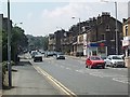
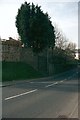
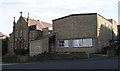
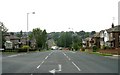
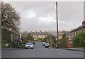
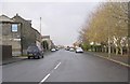
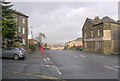
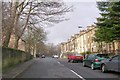
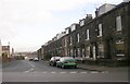
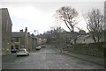
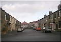
Photos of BD7 4BP

Area Information
Living in BD7 4BP means inhabiting a tightly packed residential cluster within the historic Great Horton ward of Bradford. The area spans 5,544 square metres, housing 1,483 people in a densely populated setting with 267,483 residents per square kilometre. This small postcode lies approximately 2.5 miles south-west of Bradford city centre, nestled within a conservation area that preserves 17th- to 19th-century buildings. The ward’s urban fabric blends historic cottages, workers’ housing, and industrial remnants, reflecting its roots as a 12th-century settlement. Today, it is a compact community with proximity to retail, rail, and green spaces, though its density means every square metre is accounted for. Residents benefit from nearby amenities while navigating the challenges of limited space and a high crime risk. The area’s character is defined by its conservation status, with listed buildings like Hall’s House and Horton Park offering glimpses of its heritage amid modern living.
- Area Type
- Postcode
- Area Size
- 5544 m²
- Population
- 1483
- Population Density
- 4487 people/km²
BD7 4BP is predominantly an owner-occupied area, with 78% of homes owned by residents rather than rented. The accommodation type is primarily houses, which is unusual for a densely packed postcode but reflects the area’s historic development as a residential cluster. Given the small size of the area—just 5,544 square metres—housing stock is limited, creating a competitive market for buyers. The high home ownership rate suggests long-term residents, which may indicate stability but also limited turnover. For buyers, this means a focus on existing properties rather than new builds, with potential for investment in a conservation area. However, the small footprint means proximity to Bradford’s urban sprawl is critical, and buyers should consider the area’s constraints on expansion.
House Prices in BD7 4BP
Showing 17 properties
| Address | Type | Beds | Baths | Last Sale Price | Last Sale Date | |
|---|---|---|---|---|---|---|
| 8 Welbeck Drive, Bradford, BD7 4BP | house | - | - | £140,000 | Oct 2021 | |
| 7 Welbeck Drive, Bradford, BD7 4BP | Semi-detached | - | - | £135,000 | Mar 2021 | |
| 4 Welbeck Drive, Bradford, BD7 4BP | house | - | - | £72,000 | Oct 2018 | |
| 13 Welbeck Drive, Bradford, BD7 4BP | Semi-detached | 3 | 1 | £123,000 | Aug 2014 | |
| 12 Welbeck Drive, Bradford, BD7 4BP | Semi-detached | 3 | 1 | £120,000 | Sep 2006 | |
| 1 Welbeck Drive, Bradford, BD7 4BP | Semi-detached | - | - | £100,000 | Jan 2006 | |
| 3 Welbeck Drive, Bradford, BD7 4BP | Semi-detached | - | - | £46,000 | Feb 2002 | |
| 17 Welbeck Drive, Bradford, BD7 4BP | house | - | - | £46,750 | Jan 2001 | |
| 19 Welbeck Drive, Bradford, BD7 4BP | Detached | 5 | 1 | £39,000 | Feb 1995 | |
| 10 Welbeck Drive, Bradford, BD7 4BP | Detached | 3 | 1 | - | - |
Energy Efficiency in BD7 4BP
Daily life in BD7 4BP is shaped by its compact design and proximity to essential amenities. Within walking distance are five retail outlets, including Tesco Bradford and Aldi Clayton, offering grocery and household essentials. The area’s railway stations provide easy access to Bradford’s cultural and commercial hubs. Nearby, Horton Park—a public park opened in 1878—offers green space for leisure, while the conservation area preserves historic buildings like Hall’s House and the Old Bell Chapel. The mix of retail, transport, and heritage sites creates a convenient, if small-scale, lifestyle. Residents benefit from the area’s walkability and the charm of its listed architecture, though the density means personal space is at a premium.
Amenities
Schools
| Rank | School | Type | Entry gender | Ages |
|---|
Explore more schools in this area
Go to Schools tabDemographics
The population of BD7 4BP is 1,483, with a median age of 47 and the majority of residents aged between 30 and 64. This suggests a community of established adults, many likely in their prime working years. Home ownership is high at 78%, indicating a stable, long-term resident base. The predominant accommodation type is houses, which aligns with the area’s historic development as a residential cluster. The largest ethnic group is the Asian community, though specific proportions are not quantified. The age profile and ownership rates suggest a mature, settled population, with fewer young families or transient residents. The high proportion of adults may reflect a focus on single-person or couple households, though data on household composition is absent.
Household Size
Accommodation Type
Tenure
Ethnic Group
Religion
Household Composition
Age
Household Deprivation
NS-SEC
Explore more demographic insights in this area
Go to Demographics tabPlanning
Planning Constraints
- Flood RiskPremium
- Ramsar Wetland SitesPremium
- Area of Outstanding Natural BeautyPremium
- Protected Nature ReservePremium
- Protected WoodlandPremium