Area Overview for BD7 3PH
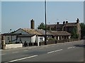
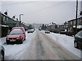
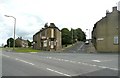
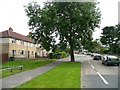
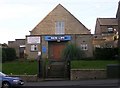
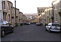
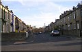
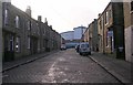
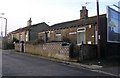
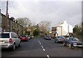
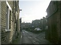
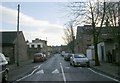
Photos of BD7 3PH
Area Information
Living in BD7 3PH means inhabiting a compact, densely populated postcode in the heart of Great Horton, a historic ward within Bradford, West Yorkshire. The area covers just 3,270 m², yet it holds 1,862 residents, creating a high population density of 569,365 people per km². This small cluster sits approximately 2.5 miles south-west of Bradford city centre, blending urban convenience with preserved historic character. Great Horton’s conservation area status safeguards 17th- to 19th-century buildings, including listed structures like Hall’s House and Horton Park, a public space dating to 1878. Daily life here is shaped by proximity to Bradford’s industrial heritage and modern amenities, with a mix of retail, transport links, and community spaces. The area’s compact size means residents are close to essential services, though the density can influence the pace of life. For buyers, BD7 3PH offers a unique blend of preserved architecture and contemporary living, ideal for those seeking a compact, connected urban environment with historical depth.
- Area Type
- Postcode
- Area Size
- 3270 m²
- Population
- 1862
- Population Density
- 8705 people/km²
The property market in BD7 3PH is characterised by a 58% home ownership rate, with houses forming the majority of accommodation. This suggests a mix of owner-occupied homes and rental properties, though the exact proportion of rentals is not specified. Given the area’s small size and high population density, housing stock is likely limited, making competition for properties intense. The prevalence of houses, rather than flats or apartments, indicates a focus on family-friendly living, supported by nearby schools and amenities. Buyers should consider the compact nature of the postcode, as immediate surroundings may offer limited expansion. The conservation area status adds value through preserved historic buildings, but it may also impose restrictions on property modifications. For those seeking a balance between urban convenience and architectural heritage, BD7 3PH presents opportunities, though availability is constrained by its size and demand.
House Prices in BD7 3PH
Showing 25 properties
| Address | Type | Beds | Baths | Last Sale Price | Last Sale Date | |
|---|---|---|---|---|---|---|
| 62 Daisy Street, Bradford, BD7 3PH | Terraced | 2 | 1 | £50,000 | Jan 2025 | |
| 54 Daisy Street, Bradford, BD7 3PH | Terraced | 2 | 1 | £40,000 | Nov 2023 | |
| 59 Daisy Street, Bradford, BD7 3PH | Retail | 2 | 1 | £57,000 | Mar 2023 | |
| 60 Daisy Street, Bradford, BD7 3PH | Terraced | 2 | 1 | £77,000 | Dec 2022 | |
| 50 Daisy Street, Bradford, BD7 3PH | Terraced | 2 | 1 | £39,000 | Dec 2022 | |
| 53 Daisy Street, Bradford, BD7 3PH | Terraced | 2 | 1 | £66,000 | Mar 2022 | |
| 52 Daisy Street, Bradford, BD7 3PH | Terraced | 2 | 1 | £50,750 | May 2021 | |
| 56 Daisy Street, Bradford, BD7 3PH | Terraced | 2 | 1 | £68,000 | Dec 2020 | |
| 63 Daisy Street, Bradford, BD7 3PH | house | - | - | £39,995 | Jan 2017 | |
| 67 Daisy Street, Bradford, BD7 3PH | house | 2 | 1 | £41,000 | Mar 2016 |
Energy Efficiency in BD7 3PH
Life in BD7 3PH is shaped by its compact size and proximity to essential amenities. Retail options include five notable venues such as Tesco Bradford and Aldi Clayton, providing access to groceries and everyday essentials. The area’s rail network, with stations like Bradford Interchange and Forster Square, ensures easy travel to Bradford’s city centre and surrounding areas. While specific parks are not listed in the data, the nearby Horton Park—a public space dating to 1878—offers greenery and recreational opportunities. The conservation area status adds to the lifestyle, with historic buildings and listed sites contributing to a distinct character. The mix of retail, transport, and preserved architecture creates a convenient yet historically rich environment. Residents benefit from a walkable community where daily needs are met locally, though the area’s density means shared spaces and services are frequently used. This blend of practicality and heritage defines the lifestyle in BD7 3PH.
Amenities
Schools
Residents of BD7 3PH have access to three primary schools within practical reach: Southmere Primary School, Southmere Primary Academy, and a second instance of Southmere Primary Academy rated ‘good’ by Ofsted. The duplication of school names may reflect different sites or phases of the same institution. The presence of two primary academies suggests a focus on education, with one school receiving a positive rating for quality. Families benefit from multiple options for early education, though the lack of secondary schools in the data implies reliance on nearby Bradford institutions. The concentration of primary schools supports a community-oriented approach to education, ensuring children have access to schooling without long commutes. However, the absence of specific data on school capacity or performance beyond Ofsted ratings means prospective buyers should investigate further to assess suitability for their needs.
| Rank | School | Type | Entry gender | Ages |
|---|
Explore more schools in this area
Go to Schools tabDemographics
BD7 3PH’s population skews young, with a median age of 22, though the most common age range is adults aged 30–64. This suggests a community balancing younger residents with a stable working-age population. Home ownership stands at 58%, with houses being the predominant accommodation type. The area’s demographic profile is shaped by its Asian_total ethnic group as the largest cohort, reflecting broader trends in Bradford’s diversity. The high population density—over 569,000 people per km²—means shared spaces and services are in constant use. While this density can foster a sense of community, it also places pressure on local infrastructure. The relatively low median age may indicate a younger workforce or student population, though the presence of families is evident in the availability of primary schools. This mix of demographics creates a dynamic but tightly knit environment, where proximity to amenities and transport is both a convenience and a challenge.
Household Size
Accommodation Type
Tenure
Ethnic Group
Religion
Household Composition
Age
Household Deprivation
NS-SEC
Explore more demographic insights in this area
Go to Demographics tabPlanning
Planning Constraints
- Flood RiskPremium
- Ramsar Wetland SitesPremium
- Area of Outstanding Natural BeautyPremium
- Protected Nature ReservePremium
- Protected WoodlandPremium