Area Overview for BD7 3JZ
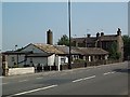
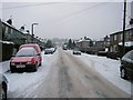
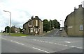
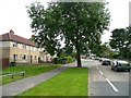
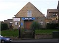
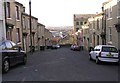
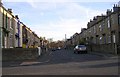
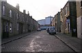
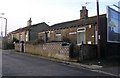
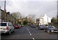
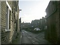
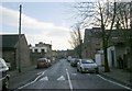
Photos of BD7 3JZ
Area Information
Living in BD7 3JZ means inhabiting a densely populated, compact postcode area in the City of Bradford, England. With a population of 1,874 spread across 9,152 square metres, the area is intensely urban, reflecting its historical evolution from a pre-industrial farming settlement to a hub of industrial housing. Today, it is a small residential cluster with a median age of 22, though the most common age group is adults aged 30–64. This mix of younger residents and established families creates a dynamic but tightly knit community. The area’s proximity to key amenities, including five retail outlets and multiple rail stations, ensures daily life is convenient, though the high population density of 204,754 people per square kilometre underscores its compact nature. BD7 3JZ sits within Little Horton, a ward with a layered history of rural tranquillity and industrial transformation, now characterised by a diverse population where Asian communities form the predominant group. For buyers, the area offers proximity to schools, transport, and a sense of local identity, though its small size means limited housing options.
- Area Type
- Postcode
- Area Size
- 9152 m²
- Population
- 1874
- Population Density
- 7053 people/km²
The property market in BD7 3JZ is characterised by low home ownership, with only 38% of households owning their homes. This suggests a rental-dominated market, likely driven by the area’s compact size and limited housing stock. The accommodation type is predominantly houses, which is atypical for a densely populated urban postcode. This mix of house ownership and rental availability may appeal to buyers seeking larger properties, though the small area size means housing options are limited. The high population density of 204,754 people per square kilometre further constrains the market, potentially increasing competition for available properties. For buyers, the area’s proximity to schools, transport, and retail amenities is a draw, but the small footprint of BD7 3JZ means that immediate surroundings, such as nearby wards, may offer more housing diversity.
House Prices in BD7 3JZ
Showing 4 properties
| Address | Type | Beds | Baths | Last Sale Price | Last Sale Date | |
|---|---|---|---|---|---|---|
| 248 Hudson Avenue, Bradford, BD7 3JZ | Flat | - | - | £37,000 | Nov 2011 | |
| 246 Hudson Avenue, Bradford, BD7 3JZ | Flat | - | - | - | - | |
| 244 Hudson Avenue, Bradford, BD7 3JZ | Flat | - | - | - | - | |
| 242 Hudson Avenue, Bradford, BD7 3JZ | Flat | - | - | - | - |
Energy Efficiency in BD7 3JZ
Residents of BD7 3JZ benefit from nearby retail and transport hubs, with five retail outlets, including Asda Little, Tesco Bradford, and Aldi Clayton, within easy reach. These shops provide everyday convenience, from groceries to household essentials. The area’s rail network, with five stations, ensures swift access to Bradford’s transport system, connecting residents to employment, healthcare, and leisure opportunities. While the data does not specify parks or recreational facilities, the area’s historical landmarks, such as All Saints’ Church and the Margaret McMillan Teacher Training College, add cultural and architectural interest. The compact nature of BD7 3JZ means that daily life is centred around these immediate amenities, with a focus on practicality and proximity. The mix of retail, transport, and historical sites creates a lifestyle that balances urban convenience with a sense of local heritage.
Amenities
Schools
Residents of BD7 3JZ have access to Horton Park Primary School, which holds an Ofsted rating of ‘good’, and Canterbury Nursery School and Centre for Children and Families, a nursery school. The presence of both primary and nursery schools within the area provides families with a seamless educational pathway for young children. Horton Park Primary School’s ‘good’ rating indicates a satisfactory standard of education, though parents may seek additional information on curriculum specifics or extracurricular offerings. The proximity of these schools to homes in BD7 3JZ is a key advantage for families prioritising convenience. However, the absence of secondary schools in the immediate area may require families to consider commuting options or broader regional schooling. The mix of school types reflects the community’s focus on early education and childcare, aligning with the area’s demographic profile of working-age adults and young families.
| Rank | School | Type | Entry gender | Ages |
|---|
Explore more schools in this area
Go to Schools tabDemographics
BD7 3JZ has a median age of 22, though the most common age range among residents is 30–64 years, indicating a community skewed towards working-age adults. Home ownership in the area is low, with only 38% of households owning their homes, suggesting a significant portion of the population rents. The accommodation type is predominantly houses, which is unusual in densely populated urban areas. The predominant ethnic group is Asian_total, reflecting the area’s historical demographic shifts, including post-war migration from South Asia and Africa. This diversity shapes the cultural fabric of the community. However, the area’s high population density and historical designation as the second most deprived ward in the UK in the late 1990s suggest challenges in quality of life, such as limited green space and potential pressures on local services. These factors influence the lived experience of residents, balancing a vibrant, multicultural environment with the realities of urban density.
Household Size
Accommodation Type
Tenure
Ethnic Group
Religion
Household Composition
Age
Household Deprivation
NS-SEC
Explore more demographic insights in this area
Go to Demographics tabPlanning
Planning Constraints
- Flood RiskPremium
- Ramsar Wetland SitesPremium
- Area of Outstanding Natural BeautyPremium
- Protected Nature ReservePremium
- Protected WoodlandPremium