Area Overview for BD7 2HJ
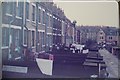
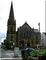
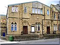
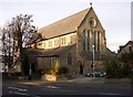
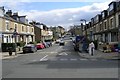
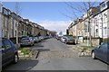
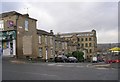
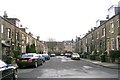
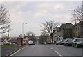
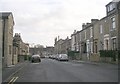
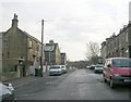
Photos of BD7 2HJ

Area Information
Living in BD7 2HJ means being part of a densely populated residential cluster in the City of Bradford, West Yorkshire. The area covers 3,892 square metres and is home to 2,824 people, making it one of the most densely populated places in England, with 725,595 people per square kilometre. This postcode is part of the Great Horton conservation area, a historic ward that once functioned as a rural settlement before 19th-century industrial growth transformed it. Today, it blends 17th- and 18th-century buildings with workers’ housing, preserving its heritage amid urban expansion. Residents benefit from proximity to Bradford city centre, just 2.5 miles away, and access to nearby amenities like retail hubs and rail links. The area’s compact size means it’s ideal for those seeking a mix of history, convenience, and connectivity, though its density may feel intense for some. With a median age of 22 and a majority of residents aged 30–64, it’s a community with a balance of young professionals and established families, shaped by its industrial past and ongoing urban development.
- Area Type
- Postcode
- Area Size
- 3892 m²
- Population
- 2824
- Population Density
- 9496 people/km²
The property market in BD7 2HJ is dominated by owner-occupied homes, with 64% of residents living in their own properties. The predominant accommodation type is houses, which is unusual for a densely populated urban area but aligns with the conservation area’s preservation of historic buildings and workers’ housing from the 18th and 19th centuries. This suggests a mix of larger, older properties and more modest homes, reflecting the area’s industrial heritage. Given the postcode’s small size and high density, the housing stock is limited, and buyers may need to consider nearby areas for additional options. The conservation area status may also influence property values, with historic features potentially attracting buyers interested in heritage or character homes. However, the compact nature of BD7 2HJ means the immediate surroundings are critical for finding alternative properties, particularly for those seeking more space or different housing types.
House Prices in BD7 2HJ
Showing 32 properties
| Address | Type | Beds | Baths | Last Sale Price | Last Sale Date | |
|---|---|---|---|---|---|---|
| 41 Hartington Terrace, Bradford, BD7 2HJ | Terraced | 3 | 1 | £101,000 | Mar 2025 | |
| 55 Hartington Terrace, Bradford, BD7 2HJ | house | - | - | £80,000 | Jan 2025 | |
| 35 Hartington Terrace, Bradford, BD7 2HJ | house | 3 | 1 | £105,000 | Sep 2024 | |
| 11 Hartington Terrace, Bradford, BD7 2HJ | Terraced | 3 | 1 | £105,000 | Jan 2023 | |
| 3 Hartington Terrace, Bradford, BD7 2HJ | house | 3 | 1 | £83,000 | Jul 2022 | |
| 53 Hartington Terrace, Bradford, BD7 2HJ | house | - | - | £70,000 | Nov 2021 | |
| 27 Hartington Terrace, Bradford, BD7 2HJ | house | - | - | £70,000 | Nov 2019 | |
| 29 Hartington Terrace, Bradford, BD7 2HJ | house | - | - | £106,000 | Apr 2019 | |
| 59 Hartington Terrace, Bradford, BD7 2HJ | house | - | - | £70,000 | May 2012 | |
| 47 Hartington Terrace, Bradford, BD7 2HJ | house | - | - | £88,000 | Mar 2012 |
Energy Efficiency in BD7 2HJ
Residents of BD7 2HJ have access to a range of amenities within practical reach. Nearby retail options include major supermarkets such as Asda Bradford, Tesco Bradford, and Aldi Clayton, ensuring convenient access to groceries and daily essentials. The area’s rail connectivity, with five nearby stations, provides easy access to Bradford city centre and surrounding regions, supporting both commuting and leisure travel. While the data does not specify parks or leisure facilities, the Great Horton Conservation Area includes historic buildings, public spaces like Horton Park (opened in 1878), and listed structures, offering opportunities for walking, cultural exploration, and community engagement. The compact nature of the area means amenities are closely clustered, though the lack of detailed information on dining or recreational venues leaves some aspects of daily life unquantified.
Amenities
Schools
The nearest school to BD7 2HJ is Al-Markaz Academy, an independent institution. No other schools are listed in the data, so families relying on state education may need to look beyond the immediate area. The presence of an independent school suggests a focus on private education, though it does not indicate the quality or Ofsted rating of the school. For families prioritising state schools, the lack of nearby options could be a drawback, requiring consideration of commuting distances or alternative educational provisions. The absence of further schools in the data means the full range of educational choices available to residents is unclear, but Al-Markaz Academy’s inclusion highlights the area’s potential appeal to those seeking private schooling.
| Rank | School | Type | Entry gender | Ages |
|---|
Explore more schools in this area
Go to Schools tabDemographics
The population of BD7 2HJ is 2,824, with a median age of 22, though the most common age range is 30–64 years. This suggests a mix of younger residents and middle-aged adults, possibly reflecting the area’s industrial history and ongoing housing needs. Home ownership stands at 64%, indicating a significant portion of residents live in their own homes, while the remaining 36% may be renters or in other tenure types. The predominant accommodation type is houses, which aligns with the conservation area’s character of larger, historic properties. The predominant ethnic group is the Asian_total category, highlighting the area’s cultural diversity. However, specific data on deprivation or socioeconomic status is absent, so broader implications for quality of life remain unquantified. The high population density—725,595 people per square kilometre—suggests a compact, possibly high-pressure living environment, though this is typical of urbanised historic wards like Great Horton.
Household Size
Accommodation Type
Tenure
Ethnic Group
Religion
Household Composition
Age
Household Deprivation
NS-SEC
Explore more demographic insights in this area
Go to Demographics tabPlanning
Planning Constraints
- Flood RiskPremium
- Ramsar Wetland SitesPremium
- Area of Outstanding Natural BeautyPremium
- Protected Nature ReservePremium
- Protected WoodlandPremium