Area Overview for BD7 2EL
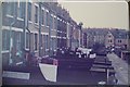
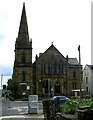
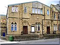
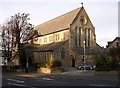
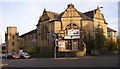
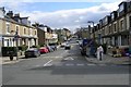
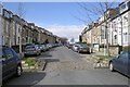
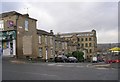
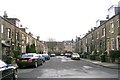
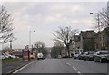
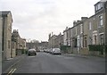
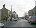
Photos of BD7 2EL
Area Information
Living in BD7 2EL means being part of a densely populated, compact residential cluster in the heart of Bradford, West Yorkshire. This postcode area covers just 5,924 square metres, yet it hosts 2,109 residents, translating to a population density of over 356,000 people per square kilometre. Situated within the City Ward, BD7 2EL is defined by its urban boundaries, centred around Bradford’s inner ring road. Daily life here is shaped by proximity to the city’s core, with a mix of residential and commercial activity. The area’s small footprint means amenities and services are closely clustered, though the high density may influence the pace of life. For those seeking a central location with access to urban infrastructure, BD7 2EL offers a compact, connected environment. However, its size also means the community is tightly knit, with shared spaces and local landmarks forming the backdrop to everyday routines. The area’s history as part of Bradford’s city centre adds a layer of cultural and historical context, though modern living here is defined by practicality and accessibility.
- Area Type
- Postcode
- Area Size
- 5924 m²
- Population
- 2109
- Population Density
- 12290 people/km²
The property market in BD7 2EL is characterised by a high rate of home ownership (73%) and a predominance of houses, which is unusual for a high-density urban postcode. This suggests a focus on owner-occupied properties rather than a rental market, potentially offering buyers a sense of security and long-term investment. However, the area’s small size means the housing stock is limited, with little scope for new developments. The presence of houses in such a compact area may indicate older, established properties rather than modern housing. For buyers, this means competition for available homes and a need to consider proximity to amenities. The high home-ownership rate also implies a stable community, which could be appealing to those seeking a settled environment.
House Prices in BD7 2EL
Showing 44 properties
| Address | Type | Beds | Baths | Last Sale Price | Last Sale Date | |
|---|---|---|---|---|---|---|
| 33 Aberdeen Terrace, Lidget Green, Bradford, BD7 2EL | house | - | - | £60,000 | Jul 2023 | |
| 39 Aberdeen Terrace, Lidget Green, Bradford, BD7 2EL | Terraced | 4 | 1 | £110,000 | Nov 2022 | |
| 11 Aberdeen Terrace, Lidget Green, Bradford, BD7 2EL | Terraced | 4 | 1 | £97,000 | Aug 2020 | |
| 5 Aberdeen Terrace, Lidget Green, Bradford, BD7 2EL | Terraced | 3 | 1 | £85,000 | Dec 2016 | |
| 15 Aberdeen Terrace, Lidget Green, Bradford, BD7 2EL | house | 3 | - | £78,000 | Dec 2016 | |
| 22 Aberdeen Terrace, Lidget Green, Bradford, BD7 2EL | house | - | - | £75,000 | Feb 2014 | |
| 2 Aberdeen Terrace, Lidget Green, Bradford, BD7 2EL | house | - | - | £60,000 | Mar 2011 | |
| 23 Aberdeen Terrace, Lidget Green, Bradford, BD7 2EL | house | - | - | £100,000 | Jan 2011 | |
| 37 Aberdeen Terrace, Lidget Green, Bradford, BD7 2EL | house | - | - | £57,000 | Oct 2010 | |
| 28 Aberdeen Terrace, Lidget Green, Bradford, BD7 2EL | Terraced | - | - | £110,000 | Aug 2007 |
Energy Efficiency in BD7 2EL
The lifestyle in BD7 2EL is shaped by its proximity to retail and transport hubs. Nearby amenities include major supermarkets such as Asda Bradford, Tesco Bradford, and Morrisons Scholemoor, ensuring easy access to shopping and daily essentials. The area’s rail network, with stations like Bradford Forster Square and Bradford Interchange, connects residents to broader regional transport systems. While the data does not specify parks or leisure facilities, the compact nature of the area suggests that public spaces are limited, with community interaction likely centred around local shops and transport nodes. The convenience of nearby retail and transport options makes daily life efficient, though the high density may mean limited private outdoor space.
Amenities
Schools
Residents of BD7 2EL have access to several primary schools, including Horton Grange Primary School and Farnham Primary School, both of which hold an Ofsted rating of ‘good’. Waverley Middle School is also listed, though its Ofsted rating is not specified. The concentration of primary schools suggests a focus on early education, which is crucial for families with young children. The presence of two schools with ‘good’ ratings indicates a reliable standard of education, though the absence of secondary schools nearby may require families to consider commuting for older children. The mix of school types ensures options for different age groups, but the lack of secondary-level institutions could be a consideration for those planning long-term stays.
| Rank | School | Type | Entry gender | Ages |
|---|
Explore more schools in this area
Go to Schools tabDemographics
The population of BD7 2EL is predominantly adults aged 30–64, with a median age of 22, suggesting a mix of younger and middle-aged residents. Home ownership is high at 73%, indicating a stable, long-term community. The accommodation type is primarily houses, which is notable in a high-density urban area. The predominant ethnic group is Asian, reflecting broader demographic trends in Bradford. The population density of 356,000 people per square kilometre is exceptionally high, comparable to major metropolitan centres, which may influence the character of public spaces and social interactions. This density, combined with a strong home-ownership rate, suggests a community that values stability and proximity to urban amenities. However, the high concentration of people in a small area may also mean limited private outdoor space and a reliance on shared community resources.
Household Size
Accommodation Type
Tenure
Ethnic Group
Religion
Household Composition
Age
Household Deprivation
NS-SEC
Explore more demographic insights in this area
Go to Demographics tabPlanning
Planning Constraints
- Flood RiskPremium
- Ramsar Wetland SitesPremium
- Area of Outstanding Natural BeautyPremium
- Protected Nature ReservePremium
- Protected WoodlandPremium