Area Overview for BD7 1NX
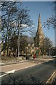
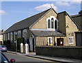
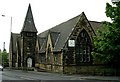
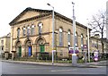
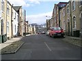
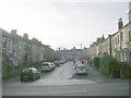
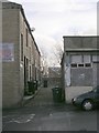
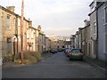
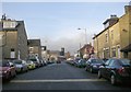
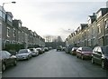
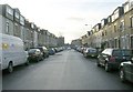
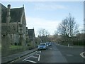
Photos of BD7 1NX
Area Information
Living in BD7 1NX places you in the heart of Bradford’s city centre, within the inner ring road. This small postcode area covers just 1.0 hectare, yet it is densely populated, with 2,051 residents packed into 202,577 people per square kilometre. The area is defined by its urban boundaries and forms part of the City Ward, a historic electoral district within the City of Bradford Metropolitan District Council. Daily life here is shaped by proximity to retail, transport hubs, and educational institutions. The compact nature of the area means residents are within walking distance of key amenities, though the limited space also reflects the challenges of urban density. With a median age of 22, the population skews younger than the national average, but the most common age range is adults aged 30–64, suggesting a mix of long-term residents and newer arrivals. The area’s character is influenced by its location in West Yorkshire, where the broader Bradford area has a rich industrial and cultural history. For buyers, BD7 1NX offers a compact, connected environment with access to city-centre conveniences, though the small footprint means properties are tightly clustered.
- Area Type
- Postcode
- Area Size
- 1.0 hectares
- Population
- 2051
- Population Density
- 7622 people/km²
The property market in BD7 1NX is characterised by a low home ownership rate of 40%, suggesting that the area is more rental-oriented than owner-occupied. Despite this, the predominant accommodation type is houses, which is uncommon in a densely populated urban postcode. This mix may indicate a blend of older, family-friendly homes and newer developments catering to different buyer needs. The small area size of 1.0 hectare means the housing stock is limited, and properties are tightly clustered, which could affect availability for buyers seeking larger plots or more space. For those considering purchase, the proximity to retail, transport, and schools is a key draw, but the compact nature of the area means competition for properties may be fierce. Buyers should also consider the high population density, which may impact privacy or noise levels. The focus on houses rather than flats suggests a preference for traditional housing, though the lack of data on property prices or recent sales trends limits further insight into market dynamics.
House Prices in BD7 1NX
Showing 5 properties
| Address | Type | Beds | Baths | Last Sale Price | Last Sale Date | |
|---|---|---|---|---|---|---|
| Islamic Missionary College, 28 Shearbridge Road, Bradford, BD7 1NX | Flat | 1 | 1 | £40,000 | Oct 2020 | |
| Biryani Hut, Shearbridge Road, Bradford, BD7 1NX | shop | - | - | - | - | |
| Sagu Motors, 30 Shearbridge Road, Bradford, BD7 1NX | office_workshop | - | - | - | - | |
| Unit 1, Wholesale Buildings, Shearbridge Road, Bradford, BD7 1NX | Industrial | - | - | - | - | |
| Mumbai Bites, Bombay Stores, Shearbridge Road, Bradford, BD7 1NX | Restaurant | - | - | - | - |
Energy Efficiency in BD7 1NX
Residents of BD7 1NX benefit from a range of retail and transport amenities within close proximity. The area is served by five notable retail outlets, including Asda Little, Tesco Bradford, and Lidl Bankfoot, providing everyday shopping needs. These stores cater to a variety of budgets and preferences, ensuring convenience for residents. The presence of multiple railway stations, such as Bradford Foster Square and Bradford Interchange, enhances connectivity, making it easy to travel to other parts of Bradford or beyond. While the data does not mention parks or leisure facilities, the compact nature of the area suggests that residents may rely on nearby city-centre amenities for recreation. The combination of retail options and transport links creates a lifestyle that prioritises accessibility and practicality, though the limited space means the area’s character is defined more by its density than by expansive green spaces or leisure facilities.
Amenities
Schools
The nearest school to BD7 1NX is Copthorne Primary School, which is listed twice in the data, both times with an Ofsted rating of outstanding. This suggests the school is a key local institution, though no secondary schools are mentioned in the data. The presence of a primary school with a top rating is a significant advantage for families, offering high-quality education close to home. However, the absence of secondary schools in the immediate vicinity may require families to seek options further afield, which could be a consideration for long-term residency. The school’s rating indicates strong performance in areas such as pupil outcomes and staff quality, which is likely to attract buyers prioritising education. With no other schools listed, the area’s educational infrastructure appears to focus on primary education, leaving a gap for secondary schooling that may need addressing for growing families.
| Rank | School | Type | Entry gender | Ages |
|---|
Explore more schools in this area
Go to Schools tabDemographics
The population of BD7 1NX is 2,051, with a median age of 22, though the most common age range is adults aged 30–64. This suggests a demographic shift, where younger residents may be balancing with older, more established households. Home ownership is relatively low at 40%, indicating that a majority of residents rent their homes. The accommodation type is predominantly houses, which is unusual for a densely populated urban area, hinting at a mix of older housing stock and newer developments. The predominant ethnic group is the Asian_total category, reflecting Bradford’s broader demographic profile as a diverse city. While specific deprivation data is not provided, the high population density and reliance on rental housing may influence quality of life, potentially affecting access to private amenities or investment in property. The age profile also suggests a community with a mix of young professionals and families, though the lack of data on household composition limits deeper analysis.
Household Size
Accommodation Type
Tenure
Ethnic Group
Religion
Household Composition
Age
Household Deprivation
NS-SEC
Explore more demographic insights in this area
Go to Demographics tabPlanning
Planning Constraints
- Flood RiskPremium
- Ramsar Wetland SitesPremium
- Area of Outstanding Natural BeautyPremium
- Protected Nature ReservePremium
- Protected WoodlandPremium