Area Overview for BD4 0RG
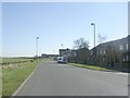
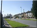
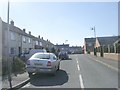
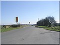
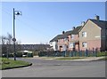
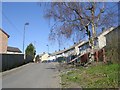
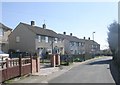
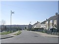
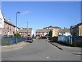
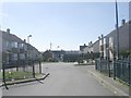
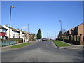
Photos of BD4 0RG

Area Information
Living in BD4 0RG means residing within a specific postcode cluster that spans 4.4 hectares in West Yorkshire. Despite its compact footprint, this residential zone holds a population of 1,448 people, creating a tightly knit environment where neighbours know one another. The area sits within the historic Tong Ward, a district that originally functioned as a pre-Norman Conquest settlement and manor on land between Ringshaw Beck and Cockersdale. Today, the village retains its identity as part of the City of Bradford metropolitan district, located southeast of the city centre along Tong Lane. You are stepping into an area with deep historical roots, where the name Tong derives from the Old English term for a fork or tongue. Much of the housing and architecture dates back to the 18th century, reflecting a quiet permanence that distinguishes this location. The high population density of 33,285 people per square kilometre indicates a concentrated living arrangement typical of mixed-use villages rather than sprawling suburbs. As you consider purchasing homes in BD4 0RG, you are choosing a location defined by its specific geography and long-standing community character rather than modern expansion. This is a place where the past influences the present, offering a distinct alternative to larger urban developments.
- Area Type
- Postcode
- Area Size
- 4.4 hectares
- Population
- 1448
- Population Density
- 3471 people/km²
Understanding the property market in BD4 0RG requires looking at the housing stock and ownership patterns specific to this postcode. Houses form the main type of accommodation, meaning you will not find high-rise flats or purpose-built rentals in this area. The home ownership rate sits at 21%, a figure that classifies this as primarily a rental market rather than an owner-occupied one. Consequently, if you are looking to buy homes in BD4 0RG, you are accessing a small slice of a predominantly private-rented sector. This situation often arises in post-1974 boundary areas where the civil parish of Tong was absorbed into the larger City of Bradford, altering the original character of the housing stock. The low percentage of owner-occupiers suggests high rental turnover and a transient population in parts of the ward. You may find homes that have been flipped frequently or possess features catering to long-term tenants rather than owners making capital improvements. The accommodation type is strictly houses, which limits the variety of property layouts available to you. This concentration on detached or semi-detached styles contrasts with the high density provided by the population numbers. For buyers, this means you are purchasing part of a historic residential cluster where the market dynamics are heavily influenced by the local authority and migration patterns rather than traditional local inheritance of property.
House Prices in BD4 0RG
Showing 13 properties
| Address | Type | Beds | Baths | Last Sale Price | Last Sale Date | |
|---|---|---|---|---|---|---|
| Holme Bank Cottage, 18 Ned Lane, Bradford, BD4 0RG | Semi-detached | 2 | 1 | £180,000 | Dec 2023 | |
| 14, Holme Bank Lodge Barn, Holme Bank, Ned Lane, Bradford, BD4 0RG | Bungalow | - | - | £198,000 | Sep 2020 | |
| Holme Bank Lodge, 16 Ned Lane, Bradford, BD4 0RG | Semi-detached | 3 | 1 | £72,000 | Mar 2009 | |
| Holmebank House, Holmebank Farm, Ned Lane, Bradford, BD4 0RG | Cottage | 3 | 1 | - | - | |
| Holmebank Heights, Holmebank Farm, Ned Lane, Bradford, BD4 0RG | Semi-detached | 3 | 1 | - | - | |
| Holmebank Fold, Holmebank Farm, Ned Lane, Bradford, BD4 0RG | Semi-detached | 3 | - | - | - | |
| Holmebank View, Holmebank Farm, Ned Lane, Bradford, BD4 0RG | house | - | - | - | - | |
| Holmebank Grange, Holmebank Farm, Ned Lane, Bradford, BD4 0RG | Terraced | 4 | - | - | - | |
| Holmebank Mistral, Holmebank Farm, Ned Lane, Bradford, BD4 0RG | house | - | - | - | - | |
| Holmebank Croft, Holmebank Farm, Ned Lane, Bradford, BD4 0RG | Terraced | 4 | 3 | - | - |
Energy Efficiency in BD4 0RG
Daily life in BD4 0RG benefits from immediate access to essential retail and transport amenities. Within practical reach are five retail outlets, specifically Morrisons Daily, Farmfoods Home, and Iceland Bradford. These supermarkets offer a full range of groceries and household essentials without the need for long drives. You can manage your weekly shopping from the very beginning of your journey, as these stores are situated close to the residential cluster. The area also provides five railway connections, reinforcing the village's role as a transport hub. Accessibility extends to major transport nodes like Bradford Interchange Railway Station and Leeds Bradford Airport. While the residential zone is compact at 4.4 hectares, the surrounding amenities ensure convenience for living in BD4 0RG. The nearby stores handle everyday needs effectively, reducing reliance on larger commercial districts for simple purchases. The combination of local food retailers and major rail links creates a functional lifestyle where practical necessities are met quickly. You do not need to travel far for basic goods, yet you retain easy access to broader city services via the rail network. This blend of local convenience and regional connectivity defines the resident experience in this historic part of West Yorkshire.
Amenities
Schools
Families considering living in BD4 0RG have access to specific educational facilities within the immediate vicinity. The only school officially listed for this area is Carrwood Primary School, which operates as a primary institution. Carrwood Primary School is the sole educational option documented for residents in this specific postcode cluster. There is no data provided for secondary schools within BD4 0RG, meaning older children must travel elsewhere for their education. This single-school offering creates a self-contained primary education hub for younger children living in the ward. The limited selection implies that primary students in BD4 0RG attend this one facility before transferring to schools outside the immediate area. Parents must plan for transport costs and travel time as their children age beyond primary years. The presence of this primary school supports the demographic of families with young children seeking education nearby. While the data does not cover sixth forms or further education colleges, the primary option provides a consistent start to the academic journey for local residents. You should verify current Ofsted ratings and school admissions policies independently, as the provided data does not include performance scores or detailed inspection outcomes. The existence of only one named school defines the educational neighbourhood for this residential cluster.
| Rank | School | Type | Entry gender | Ages |
|---|
Explore more schools in this area
Go to Schools tabDemographics
The community in BD4 0RG presents a specific age profile and living arrangement that defines daily life here. The median age for residents is 22 years, though the most common age range among the population is adults between 30 and 64 years old. This suggests a blend of young professionals and those mid-career, likely balancing work in Bradford with local living. Less than a quarter of households own their property, with just 21% of residents being home owners. This statistic highlights that the majority of homes in BD4 0RG are rented, indicating a market driven by tenants rather than long-term owner occupants. The predominant ethnic group in the area is White, pointing to a community with significant historical continuity in West Yorkshire. While the area code is small, the density means you live among immediate neighbours in close proximity. The age range of adults does not necessarily reflect the entire household composition, as the low median age suggests many young adults live with family or in shared housing. This demographic mix influences local demand, with families and young professionals sharing the same streets. The data confirms a distinct population centre where over three-quarters of residents do not own their homes, shaping the economic landscape and community stability of the ward.
Household Size
Accommodation Type
Tenure
Ethnic Group
Religion
Household Composition
Age
Household Deprivation
NS-SEC
Explore more demographic insights in this area
Go to Demographics tabPlanning
Planning Constraints
- Flood RiskPremium
- Ramsar Wetland SitesPremium
- Area of Outstanding Natural BeautyPremium
- Protected Nature ReservePremium
- Protected WoodlandPremium