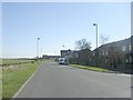
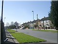
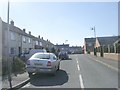
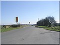
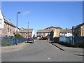
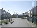
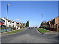
Area Overview for BD4 0RD
Photos of BD4 0RD

Area Information
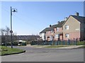
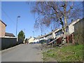
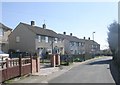
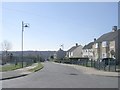
The postcode area BD4 0RD represents a specific residential cluster within the wider Pudsey ward of Leeds. This location covers 6.9 hectares and accommodates a population of 2,048 residents, resulting in a density of 1,098 people per square kilometre. You will find yourself in a setting that reflects the town's deep historical roots, situated within a landscape that has evolved from historic woollen manufacture to a quiet residential zone. The area forms part of Pudsey Urban District's legacy, which once held municipal borough status and boasted significant industrial presence before merging into the City of Leeds in 1974. Living in BD4 0RD offers a compact experience where the boundaries of your immediate neighbourhood blend with the broader town of Pudsey. The area sits at coordinates approximately 53.792048, -1.70396, placing it in the Yorkshire and the Humber region. You are close to designated conservation areas that feature 47 listed buildings, ensuring the local architecture retains its heritage character. While major commercial centres are not detailed for the immediate vicinity, the proximity to Farsley and the historic manor history adds context to your daily surroundings. This small but distinct cluster provides a grounded sense of place, rooted in the former wapentake of Morley and Calverley Parish, offering a snapshot of local history intertwined with modern community life.
- Area Type
- Postcode
- Area Size
- 6.9 hectares
- Population
- 2048
- Population Density
- 1098 people/km²
The property market in BD4 0RD is characterised by a strong emphasis on private home ownership. With 82% of residents owning their homes, the area functions primarily as an owner-occupied community rather than a rental hotspot. The insulation types of the housing stock are not provided, but the consistent accommodation type confirms that all dwellings in this 6.9-hectare stretch are houses. This uniformity means buyers looking at homes in BD4 0RD will encounter a consistent architectural style typical of the Pudsey ward. Given the high ownership rate, there are fewer letting agents active in this specific cluster compared to university towns or commuter belts. You will likely find properties listed through local contacts or traditional estate networks rather than corporate rental platforms. The concentration of family homes suggests the market is driven by buyers seeking permanence rather than short-term leases. This small residential cluster does not offer the variety of property types found in larger postcodes, but it provides a stable environment for those wishing to secure a house with a clear title. The absence of flats or shared ownership schemes in the data indicates a straightforward market for conventional house purchasers.
House Prices in BD4 0RD
Showing 7 properties
| Address | Type | Beds | Baths | Last Sale Price | Last Sale Date | |
|---|---|---|---|---|---|---|
| 15, Harper Gate, Tyersal Lane, Bradford, BD4 0RD | Terraced | - | - | - | - | |
| 7A, Harper Gate, Tyersal Lane, Bradford, BD4 0RD | Terraced | - | - | - | - | |
| 17A, Harper Gate, Tyersal Lane, Bradford, BD4 0RD | Terraced | - | - | - | - | |
| 17, Harper Gate, Tyersal Lane, Bradford, BD4 0RD | Terraced | - | - | - | - | |
| 9, Harper Gate, Tyersal Lane, Bradford, BD4 0RD | Terraced | - | - | - | - | |
| 7, Harper Gate, Tyersal Lane, Bradford, BD4 0RD | Terraced | - | - | - | - | |
| 11-13, Harper Gate, Tyersal Lane, Bradford, BD4 0RD | Terraced | - | - | - | - |
Energy Efficiency in BD4 0RD
Daily life for residents of BD4 0RD is supported by a range of amenities within practical reach. For your weekly shopping requirements, you have access to five retail venues, including Morrisons Daily, Farmfoods Home, and Aldi Thornbury. These names appear in the data as notable nearby options, offering essential groceries and household goods without the need for long car journeys. Transport links are equally accessible, with five railway stations nearby, including New Pudsey Station and Bradford Interchange Railway Station, facilitating easy travel across the North of England. Aviation is also close by, with two airports listed in the amenities category: Leeds Bradford Airport and Leeds Bradford International Airport. This proximity is useful for business travel or leisure holidays for those living in the area. You are situated seven miles from Leeds city centre, according to local geography, which balances the quiet of a residential cluster with the convenience of urban access. The area sits within the historic Pudsey conservation zone, meaning local parks like Pudsey Park are nearby, having been celebrated in 'Pudsey in Bloom' campaigns. The character of your lifestyle is defined by this blend of local retail utility and regional transport accessibility, all while remaining in a relatively small residential footprint.
Amenities
Schools
Parents considering homes in BD4 0RD have access to a specific selection of educational institutions nearby. Within practical reach lies Pudsey Tyersal Primary School, a primary institution that serves younger children in the locality. For older students, the area is near Co-op Academy Beckfield, an academy that holds an Ofsted rating of good. This combination of a primary school and a well-rated academy provides a clear routing for families living in the 6.9-hectare zone. The presence of Co-op Academy Beckfield with its positive rating offers reassurance regarding secondary education standards for children in this cluster. You do not need to look far for education options, as both essential school types are listed within the immediate vicinity. The mix of a local primary and an academy school creates a balanced environment where children can progress through their education stages without significant disruption. Schools near BD4 0RD are anchored by these two specific named entities, which serve the immediate community needs of the local households.
| Rank | School | Type | Entry gender | Ages |
|---|
Explore more schools in this area
Go to Schools tabDemographics
The community in BD4 0RD is defined by a settled and established population. With a median age of 47 years, the area is predominantly inhabited by adults between 30 and 64 years old. This age profile suggests a neighbourhood where stability is common, with fewer young families or very elderly residents compared to other parts of Leeds. The predominant ethnic group is White, aligning with the broader demographic makeup of the surrounding historic towns in West Yorkshire. Home ownership stands as a defining feature of this location, with 82% of households owning their homes. This high rate indicates a territory where residents have likely lived here for extended periods, choosing to stay rather than move. The accommodation type is restricted to houses, meaning you will not find flats or purpose-built apartments within this specific cluster. The lack of rental units further reinforces the owner-occupier nature of the demographic. Consequently, the local community feels cohesive, built around long-term families and individuals who have secured their own properties. There is little turnover of population, which means neighbours are likely to know each other well.
Household Size
Accommodation Type
Tenure
Ethnic Group
Religion
Household Composition
Age
Household Deprivation
NS-SEC
Explore more demographic insights in this area
Go to Demographics tabPlanning
Planning Constraints
- Flood RiskPremium
- Ramsar Wetland SitesPremium
- Area of Outstanding Natural BeautyPremium
- Protected Nature ReservePremium
- Protected WoodlandPremium