Area Overview for BD3 9SJ
Photos of BD3 9SJ
Area Information
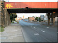
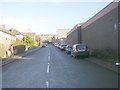
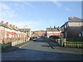
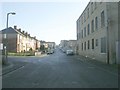
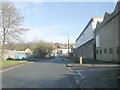
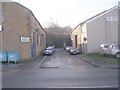
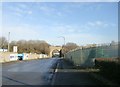
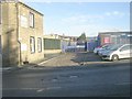
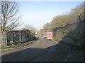
Bowling and Barkerend defines the character of BD3 9SJ, an electoral ward situated immediately east and south of Bradford city centre. This postcode covers a specific residential cluster containing 1739 people within an area of just 3044 square metres. The high population density reflects the concentration of homes near major transport arteries. Residents live near the Bradford Inner Ring Road, while some streets follow the route of the railway line connecting to Halifax. The ward boundaries incorporate local thoroughfares such as Rooley Lane, Dick Lane, and Otley Road. Historical threads run through BD3 9SJ, from the Barkerend workhouse established in 1738 to the steam-powered Barkerend Mills founded in 1815. St Clement's Church on Barkerend Road still stands as a local landmark, featuring Pre-Raphaelite decorations by Sir Edward Burne-Jones. The community infrastructure includes the Karmand Centre, which supports outdoor cricket activities organised by the BD3 Sports Association. Families and individuals use children's centres and groups like the Barkerend Environment Group for local interaction. Living in BD3 9SJ means accepting a location with deep industrial heritage and modern connectivity, situated on the edge of Bradford's urban core.
- Area Type
- Postcode
- Area Size
- 3044 m²
- Population
- 1739
- Population Density
- 5054 people/km²
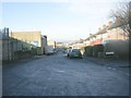
The housing stock in BD3 9SJ is defined by a predominance of Houses, reflecting the architectural legacy of the Barkerend and Bowling districts. Data indicates that 47% of homeowners in this postcode hold their properties directly, suggesting a strong element of owner-occupation alongside private renting. This balance means buyers face a market with both existing owners willing to sell and those seeking tenancies. The small area size of 3044 square metres limits large-scale development, maintaining the existing footprint of homes near the Inner Ring Road and railway lines. Prospective buyers looking at BD3 9SJ should expect a residential focus rather than commercial density. The type description notes this is a small residential cluster, which restricts the variety of property sizes available compared to larger suburbs. The 47% ownership rate implies that rental yields remain competitive for investors, while owner-occupiers have relatively low pressure to move unless circumstances change. Since the ward encompasses streets like Sticker Lane and Killinghall Road, the housing stock likely ranges from Victorian terraces to post-war conversions. You will find fewer luxury or detached variations, as the population density and ward history favour practical, multi-unit dwellings over expansive estates. This market structure offers stability but limits negotiation leverage for first-time buyers without strong financing.
House Prices in BD3 9SJ
Showing 1 properties
| Address | Type | Beds | Baths | Last Sale Price | Last Sale Date | |
|---|---|---|---|---|---|---|
| Stratton Services Limited, Hammerton Street, Bradford, BD3 9SJ | general_industrial | - | - | - | - |
Energy Efficiency in BD3 9SJ
Residents of BD3 9SJ enjoy immediate access to practical amenities without needing lengthy commutes for daily staples. Three notable retail locations sit within practical reach: Spar, Lidl Undercliffe, and Sainsburys Bradford. These shops provide food and household goods quickly for families living on streets like Birksland Street. Five rail stations serve the area, including Bradford Interchange Railway Station and Bradford Foster Square Railway Station, offering extensive connectivity. Additionally, Leeds Bradford Airport provides air travel options for one airport-related facility listed nearby. The street architecture and nearby facilities reflect the ward's mixed history. St Clement's Church on Barkerend Road adds cultural depth with its historic decorations. The Karmand Centre serves as a social hub, hosting the outdoor cricket area managed by the BD3 Sports Association. Groups such as the Barkerend Environment Group utilise community centres for local engagement. You will find children's centres supporting younger residents in the vicinity. While one might seek more diverse leisure spots, the combination of supermarkets, railway access, and community clubs creates a functional daily rhythm. Living in BD3 9SJ balances urban convenience with the established character of a local ward bounded by major roads and rail lines.
Amenities
Schools
Families in BD3 9SJ have access to specific educational institutions nearby, though options are limited within the immediate postcode. Feversham College stands as the notable independent school name listed for the area. The data does not provide private or state primary schools within the immediate listing for BD3 9SJ, meaning families often rely on independent education or commute further for state options. The presence of Feversham College offers a private education choice for residents who can afford independent fees. This single school reference suggests that BD3 9SJ acts more as a commuter gateway to wider Bradford educational facilities rather than a schooling hub. For children growing up in BD3 9SJ, the school landscape relies heavily on this one named provider and broader catchment arrangements not explicitly detailed here. The independent nature of Feversham College contrasts with the typically state-funded schools common in many UK locales. You must check admission criteria and commute times from streets like Cutler Heights or East Bowling if this home supports school runs. The lack of other listed schools means parents here prioritise travel logistics or settle with the one confirmed option. This reality shapes the local family dynamic, creating a community where education choices are specific and sometimes time-sensitive.
| Rank | School | Type | Entry gender | Ages |
|---|
Explore more schools in this area
Go to Schools tabDemographics
The community profile of BD3 9SJ shows a majority of adult residents aged between 30 and 64 years. Despite the most common age group falling within this adult bracket, the official median age for the area is recorded as 22. This discrepancy suggests a demographic mix that combines younger households with established families. Asians form the predominant ethnic group within this postcode. Housing ownership represents 47% of the local household base, meaning just under half of the residents own their homes directly. The accommodation type data confirms that Houses form the primary dwelling style in BD3 9SJ. You will find fewer flats or purpose-built blocks compared to the typical suburban economy elsewhere. This preference for houses aligns with the demographic need for family-sized spaces given the adult population concentration. With a population of 1739 people packed into a small footprint, daily interactions are frequent but specific to the street network of Rooley Lane and surrounding lanes. The home ownership figure of 47% indicates a balanced market where both investors and long-term residents coexist. Understanding these figures helps you gauge the neighbourhood's stability and typical buyer profile.
Household Size
Accommodation Type
Tenure
Ethnic Group
Religion
Household Composition
Age
Household Deprivation
NS-SEC
Explore more demographic insights in this area
Go to Demographics tabPlanning
Planning Constraints
- Flood RiskPremium
- Ramsar Wetland SitesPremium
- Area of Outstanding Natural BeautyPremium
- Protected Nature ReservePremium
- Protected WoodlandPremium