Area Overview for BD3 9RL
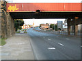
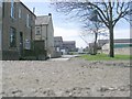
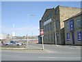
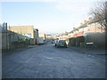
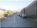
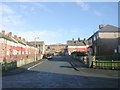
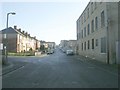
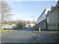
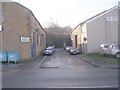
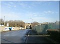
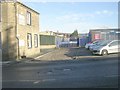
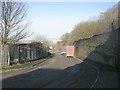
Photos of BD3 9RL
Area Information
Living in BD3 9RL means residing in a small, residential cluster in the City of Bradford, nestled east and south of the city centre. The area spans parts of Barkerend, Bowling, and nearby neighbourhoods, bounded by the Bradford Inner Ring Road and railway lines. With a population of 1,739, it is a compact community characterised by a mix of historic and modern features. The area’s proximity to Bradford’s core offers easy access to urban amenities while retaining a distinct local identity. Historically, BD3 9RL was shaped by industrial heritage, including Barkerend Mills, though much of this is now gone. Today, the area is defined by its residential streets, community centres, and proximity to transport networks. Residents benefit from nearby retail outlets, railway stations, and the Leeds Bradford Airport, making it a practical choice for those needing connectivity. The community’s demographic profile, with a median age of 22 and a significant proportion of adults aged 30–64, suggests a mix of young families and established households. This blend of characteristics makes BD3 9RL a place where local history meets contemporary living.
- Area Type
- Postcode
- Area Size
- Not available
- Population
- 1739
- Population Density
- 5054 people/km²
The property market in BD3 9RL is defined by a 47% home ownership rate, indicating that nearly half of the properties are owner-occupied, with the remainder likely rented. The area is primarily composed of houses rather than flats, a feature that aligns with its suburban residential character. This mix suggests a market skewed towards family homes and long-term investments, though the small population size means the housing stock is limited. For buyers, the focus on houses implies a preference for space and privacy, which may appeal to those seeking traditional living arrangements. However, the relatively low home ownership rate also suggests a rental market segment, potentially offering opportunities for landlords. The proximity to transport links and amenities may enhance property value, but the area’s compact size means buyers must consider immediate surroundings for additional options. The lack of high-rise or commercial properties reinforces its role as a residential enclave.
House Prices in BD3 9RL
No properties found in this postcode.
Energy Efficiency in BD3 9RL
Residents of BD3 9RL have access to a range of amenities within practical reach. Retail options include Spar, Lidl Undercliffe, and Sainsburys Bradford, ensuring everyday shopping needs are met. The area’s railway stations, such as Bradford Interchange and Forster Square, provide direct links to the city centre and beyond, enhancing mobility. The Leeds Bradford Airport is also nearby, offering travel convenience for those requiring flights. Locally, the Karmand Centre hosts community activities, including outdoor cricket, while the Barkerend Environment Group supports local initiatives. Though the data does not mention parks or dining venues, the presence of community facilities and retail outlets suggests a lifestyle focused on practicality and local engagement. The mix of retail, transport, and community hubs makes daily life in BD3 9RL efficient, though residents may need to travel further for more specialised services.
Amenities
Schools
The nearest school to BD3 9RL is Feversham College, an independent institution. While no Ofsted rating is provided, its status as an independent school suggests it may cater to specific educational preferences, potentially offering specialised curricula or smaller class sizes. The absence of other schools in the data means families relying on state education may need to look beyond the immediate area. For those prioritising independent schooling, Feversham College provides a viable option. However, the lack of nearby state schools could be a consideration for families seeking a broader range of educational choices. The school’s presence highlights the area’s appeal to households valuing alternative educational pathways, though it also underscores the need for careful planning when selecting a home.
| Rank | School | Type | Entry gender | Ages |
|---|
Explore more schools in this area
Go to Schools tabDemographics
The community in BD3 9RL is predominantly composed of adults aged 30–64, with a median age of 22, reflecting a balance between younger and older residents. Home ownership rates stand at 47%, indicating a mix of owner-occupied and rental properties. The area is characterised by houses rather than flats, which is typical of its residential layout. The predominant ethnic group is the Asian community, a reflection of broader demographic trends in Bradford. This diversity shapes the social fabric of the area, though specific data on deprivation or socioeconomic status is not provided. The population size of 1,739 suggests a tightly knit community, where local institutions and amenities play a central role. The presence of community facilities such as the Karmand Centre and groups like the Barkerend Environment Group highlights a focus on local engagement. For buyers, understanding these demographics is key to assessing the area’s character and potential for long-term residency.
Household Size
Accommodation Type
Tenure
Ethnic Group
Religion
Household Composition
Age
Household Deprivation
NS-SEC
Explore more demographic insights in this area
Go to Demographics tabPlanning
Planning Constraints
- Flood RiskPremium
- Ramsar Wetland SitesPremium
- Area of Outstanding Natural BeautyPremium
- Protected Nature ReservePremium
- Protected WoodlandPremium