Area Overview for BD21 4QH
Photos of BD21 4QH
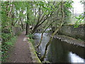
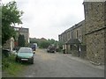
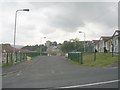
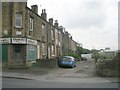
100 photos from this area
Area Information
Key information about the BD21 4QH including its size, population, and administrative classification.
- Area Type
- Postcode
- Area Size
- 1.4 hectares
- Population
- 1359
- Population Density
- 861 people/km²
House Prices in BD21 4QH
54
Properties
£67,327
Average Sold Price
£36,123
Lowest Price
£92,500
Highest Price
Showing 54 properties
| Address | Type | Beds | Baths | Last Sale Price | Last Sale Date | |
|---|---|---|---|---|---|---|
| 112 Parkwood Street, Keighley, BD21 4QH | Terraced | 2 | 1 | £80,000 | Sep 2025 | |
| 52 Parkwood Street, Keighley, BD21 4QH | Terraced | 2 | 1 | £78,000 | Jan 2024 | |
| 94 Parkwood Street, Keighley, BD21 4QH | house | - | - | £43,000 | Dec 2022 | |
| 50 Parkwood Street, Keighley, BD21 4QH | house | 4 | - | £56,000 | Nov 2022 | |
| 58 Parkwood Street, Keighley, BD21 4QH | house | - | - | £80,000 | May 2022 | |
| 76 Parkwood Street, Keighley, BD21 4QH | Terraced | 4 | 1 | £86,000 | Oct 2021 | |
| 84 Parkwood Street, Keighley, BD21 4QH | Terraced | 3 | 1 | £55,500 | Jun 2020 | |
| 118-120 Parkwood Street, Keighley, BD21 4QH | Terraced | 3 | 1 | £69,995 | Jun 2019 | |
| 78 Parkwood Street, Keighley, BD21 4QH | house | - | - | £62,000 | Feb 2019 | |
| 80 Parkwood Street, Keighley, BD21 4QH | Terraced | 3 | - | £71,500 | Dec 2018 |
Page 1 of 6
Energy Efficiency in BD21 4QH
Amenities
Schools
| Rank | School | Type | Entry gender | Ages |
|---|
Explore more schools in this area
Go to Schools tabDemographics
Household Size
Two person
most common
Accommodation Type
Houses
most common
Tenure
64
majority
Ethnic Group
White
most common
Religion
N/A
most common
Household Composition
N/A
most common
Age
47
median
Adults (30-64 years)
most common
Household Deprivation
N/A
with no deprivation
NS-SEC
24
in Lower managerial occupations
Explore more demographic insights in this area
Go to Demographics tabPlanning
Planning Constraints
- Flood RiskPremium
- Ramsar Wetland SitesPremium
- Area of Outstanding Natural BeautyPremium
- Protected Nature ReservePremium
- Protected WoodlandPremium