Area Overview for BD21 4QF
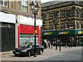
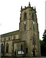
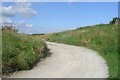
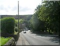
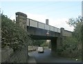
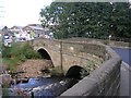
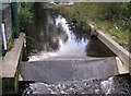
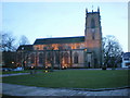
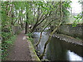
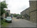
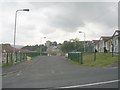
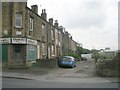
Photos of BD21 4QF
Area Information
Living in BD21 4QF means residing within a tightly defined residential cluster that covers just 1.6 hectares. This small, concentrated area forms part of the wider Keighley community in West Yorkshire. The postal code serves 1,359 people, creating a neighbourhood where streets are close together and residents often know their neighbours. The location sits at postcode BD21 4QF, offering a blend of rural proximity and town access typical of the Brodmo Edge and Eastwood sectors in Keighley. You are living in a space defined by its compact size and local integration rather than sprawling development. The area appeals to those who prefer a contained environment where daily necessities are within a short walk or drive. While the cluster is small, it connects to the historic fabric of Keighley, a town that evolved from a medieval market settlement into a modern residential hub. The specific boundary of BD21 4QF ensures you live in a distinct pocket of the district without the anonymity of larger developments. This postcode area offers a grounded experience of English county living where local history and contemporary amenities intersect. Your daily life here is shaped by the proximity to local services and the quiet nature of a low-density housing zone. The population density of 861 people per square kilometre suggests a community that feels occupied but not overcrowded. You gain access to the broader benefits of Keighley while maintaining the convenience of a smaller residential unit. The area benefits from a perimeter of farms and open spaces that contribute to its character. Residents enjoy the stability of established local landmarks and routes that have served the district for centuries. The compact footprint of BD21 4QF means distances to nearby rail and retail points are manageable. You find yourself situated in a spot that balances suburban comfort with the practicalities of commuting to Bradford or Leeds. The built environment reflects a long history of adaptation, from the turnpikes of the 18th century to the modern housing stock. Living in BD21 4QF provides a secure base from which to explore the wider Yorkshire Dales and urban centres of the region.
- Area Type
- Postcode
- Area Size
- 1.6 hectares
- Population
- 1359
- Population Density
- 861 people/km²
Buying a home in BD21 4QF involves entering a market where ownership is the norm. The area is characterised by houses, meaning freehold properties predominate over leasehold flats or managed estates. With 64% of residents owning their homes, the property market here reflects a buyer's scenario focused on long-term investment rather than short-term yields. You will find detached, semi-detached, or terraced houses typical of the Keighley and Brodmo Edge corridor. This high ownership percentage suggests properties usually move less frequently than in rental-heavy zones, ensuring neighbourhood cohesion but potentially lengthening time on market for moving buyers. The compact 1.6-hectare size limits the sheer volume of transactions, making each sale significant for local market activity. Homes in BD21 4QF often command stability due to the mature demographic of 47-year-old residents who prioritise quality over speculation. The accommodation type landscape lacks the density of urban high-rises, preserving green spaces and reducing noise pollution for prospective residents. This housing stock appeals to those who cannot or choose not to rent, given the limited independent housing market available to renters in some UK regions. While rental yields may exist, the capital growth potential here aligns with national trends for owner-occupied residential clusters. When viewing properties near Keighley Railway Station or in the immediate village fabric, buyers should note that demand revolves around family needs and remote working capabilities. The absence of a significant student population means the market is driven by middle-income earners seeking permanence. Prices reflect this stability, avoiding the volatility seen in areas dependent on a university presence or young professional influx.
House Prices in BD21 4QF
Showing 4 properties
| Address | Type | Beds | Baths | Last Sale Price | Last Sale Date | |
|---|---|---|---|---|---|---|
| 3, Parklee Court, Parkwood Rise, Keighley, BD21 4QF | Semi-detached | 2 | 1 | £73,500 | Nov 2020 | |
| 2, Parklee Court, Parkwood Rise, Keighley, BD21 4QF | house | - | - | £37,950 | Apr 2002 | |
| 1, Parklee Court, Parkwood Rise, Keighley, BD21 4QF | house | - | - | £38,950 | Dec 2001 | |
| 4, Parklee Court, Parkwood Rise, Keighley, BD21 4QF | Semi-detached | - | - | £30,000 | Apr 1998 |
Energy Efficiency in BD21 4QF
Living in BD21 4QF offers convenient access to essential retail outlets and transport links. Five notable retail locations are within practical reach, including Morrisons Eastwood, Aldi Eastwood, and Iceland Keighley. Morrisons Eastwood and Aldi Eastwood provide daily groceries, while Iceland Keighley serves frozen and chilled sections. These stores are located in the Eastwood area, a neighbouring village with strong community ties. You can stock up on essentials without driving into the urban centre of Keighley or needing significant planning. The convenience of having a supermarket and discount grocer nearby enhances the quality of daily life for busy households. Connectivity to rail hubs complements the retail offerings by enabling quick weekend getaways. Keighley Railway Station and Crossflatts Railway Station are among the five stations near your postcode. You can also reach Bingley Railway Station for inter-city travel. On the bus network, five stops serve the area, with routes stopping at Ingrow West, Damems, and Oakworth. These stops provide access to pastoral landscapes and countryside walks typical of the Keighley district. The lifestyle in BD21 4QF balances the convenience of town amenities with the tranquility of low-density living. You do not need to sacrifice green space or quiet streets to access quality food and transport. The area stands out for its mix of independent village life and proximity to large national retailers and rail services.
Amenities
Schools
Families in BD21 4QF have Parkwood Primary School on the list of options for their children. This primary school holds a Good Ofsted rating, confirming it meets the standards set by the Department for Education. You will not find secondary schools listed within the immediate vicinity of this specific postcode cluster. The school mix is therefore exclusively primary for local children under age 11 or 12. This setup requires students in BD21 4QF to travel to secondary schools elsewhere, likely into Bridgwater, Brodmo, or Keighley proper. The Good rating of Parkwood Primary School offers reassurance regarding curriculum quality and pastoral care for local youngsters. Parents value this accreditation because it indicates a safe and effective learning environment. The separation between primary and secondary provision means the community relies on outbound bus routes or driving to reach older age groups. British schools operate under local authority oversight, and Parkwood Primary serves the catchment area defined by the local council. While no secondary schools are explicitly listed in the data for BD21 4QF, residents typically access surrounding institutions for GCSE and A-level education. This geographical distribution of education facilities is standard for rural-urban fringe areas in West Yorkshire. The presence of a rated school is a critical factor for buyers who intend to raise children near BD21 4QF. You can rely on the documented Good rating when making lists of preferred educational institutions. The focus on a single primary option simplifies the selection process for local families who intend to stay in the area.
| Rank | School | Type | Entry gender | Ages |
|---|
Explore more schools in this area
Go to Schools tabDemographics
The community in BD21 4QF is defined by a mature demographic profile with a median age of 47 years. The majority of residents fall within the 30 to 64 years age range, indicating a population that prioritises stability over transient living. This skew towards adults suggests the area attracts families or professionals seeking a settled home rather than student housing or young executive apartments. Sixty-four per cent of homes are owned outright or have a mortgage, reflecting a strong culture of long-term residency and homeownership. Only 1,359 people call this small postcode their home, which fosters a cohesive social fabric where neighbouring households know one another across the 1.6-hectare boundary. The predominant ethnic group is White, aligning with the broader demographic patterns of West Yorkshire. Accommodation in BD21 4QF consists almost entirely of houses, meaning you will not find flats or purpose-built apartments dominating the streetscape. Homeownership rates of 64% mean financial transactions here are typically sales or remortgages rather than rental contracts. This high ownership level suggests tenants rarely move quickly between properties, allowing schools and local clubs to build consistent communities. The age spread of 30 to 64 years also implies a lower impact from volatile student property markets. Families with school-aged children are likely key residents, particularly given the presence of Parkwood Primary School. Single-person households and empty nesters also fit this age profile, contributing to a quieter atmosphere compared to areas with younger populations. The proportion of owner-occupiers creates a vested interest in local maintenance and safety. Residents are more likely to report concerns about propertycrime to the police than transient keys. The demographic stability supports local businesses that rely on regular customers rather than footfall from commuters.
Household Size
Accommodation Type
Tenure
Ethnic Group
Religion
Household Composition
Age
Household Deprivation
NS-SEC
Explore more demographic insights in this area
Go to Demographics tabPlanning
Planning Constraints
- Flood RiskPremium
- Ramsar Wetland SitesPremium
- Area of Outstanding Natural BeautyPremium
- Protected Nature ReservePremium
- Protected WoodlandPremium