Area Overview for BD21 1NJ
Photos of BD21 1NJ

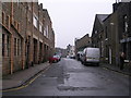
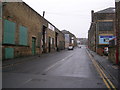
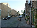
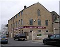

100 photos from this area
Area Information
Key information about the BD21 1NJ including its size, population, and administrative classification.
- Area Type
- Postcode
- Area Size
- 9397 m²
- Population
- 1382
- Population Density
- 7511 people/km²
House Prices in BD21 1NJ
31
Properties
£98,316
Average Sold Price
£30,000
Lowest Price
£240,000
Highest Price
Showing 31 properties
| Address | Type | Beds | Baths | Last Sale Price | Last Sale Date | |
|---|---|---|---|---|---|---|
| 27 Broomhill Grove, Keighley, BD21 1NJ | Semi-detached | 4 | 2 | £240,000 | Jun 2023 | |
| 12 Broomhill Grove, Keighley, BD21 1NJ | house | - | - | £106,000 | Sep 2018 | |
| 28 Broomhill Grove, Keighley, BD21 1NJ | house | 3 | - | £120,000 | Sep 2018 | |
| 17 Broomhill Grove, Keighley, BD21 1NJ | house | - | - | £125,000 | Sep 2017 | |
| 4 Broomhill Grove, Keighley, BD21 1NJ | Terraced | 3 | 1 | £79,000 | Jan 2016 | |
| 22 Broomhill Grove, Keighley, BD21 1NJ | house | - | - | £120,000 | Aug 2015 | |
| 1 Broomhill Grove, Keighley, BD21 1NJ | Semi-detached | 3 | 1 | £83,000 | Dec 2014 | |
| 21 Broomhill Grove, Keighley, BD21 1NJ | house | - | - | £100,000 | Apr 2014 | |
| 25 Broomhill Grove, Keighley, BD21 1NJ | house | - | - | £109,000 | Sep 2013 | |
| 5 Broomhill Grove, Keighley, BD21 1NJ | Semi-detached | 3 | - | £128,000 | May 2008 |
Page 1 of 4
Energy Efficiency in BD21 1NJ
Amenities
Schools
| Rank | School | Type | Entry gender | Ages |
|---|
Explore more schools in this area
Go to Schools tabDemographics
Household Size
Two person
most common
Accommodation Type
Houses
most common
Tenure
58
majority
Ethnic Group
White
most common
Religion
N/A
most common
Household Composition
N/A
most common
Age
47
median
Adults (30-64 years)
most common
Household Deprivation
N/A
with no deprivation
NS-SEC
19
in Lower managerial occupations
Explore more demographic insights in this area
Go to Demographics tabPlanning
Planning Constraints
- Flood RiskPremium
- Ramsar Wetland SitesPremium
- Area of Outstanding Natural BeautyPremium
- Protected Nature ReservePremium
- Protected WoodlandPremium