Area Overview for BD20 0NW
Photos of BD20 0NW


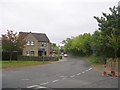
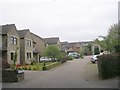
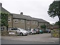

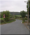
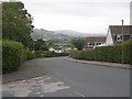
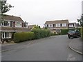
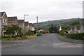
61 photos from this area
Area Information
Key information about the BD20 0NW including its size, population, and administrative classification.
- Area Type
- Postcode
- Area Size
- 6442 m²
- Population
- 1996
- Population Density
- 2034 people/km²
House Prices in BD20 0NW
9
Properties
£153,611
Average Sold Price
£55,500
Lowest Price
£265,000
Highest Price
Showing 9 properties
| Address | Type | Beds | Baths | Last Sale Price | Last Sale Date | |
|---|---|---|---|---|---|---|
| 1 Low House Drive, Silsden, Keighley, BD20 0NW | Semi-detached | 2 | 1 | £265,000 | Dec 2023 | |
| 12 Low House Drive, Silsden, Keighley, BD20 0NW | house | - | - | £198,000 | Mar 2023 | |
| 6 Low House Drive, Silsden, Keighley, BD20 0NW | house | - | - | £180,000 | Oct 2018 | |
| 8 Low House Drive, Silsden, Keighley, BD20 0NW | house | - | - | £185,000 | Sep 2018 | |
| 14 Low House Drive, Silsden, Keighley, BD20 0NW | house | - | - | £171,000 | Feb 2011 | |
| 10 Low House Drive, Silsden, Keighley, BD20 0NW | house | - | - | £164,000 | Aug 2010 | |
| 2 Low House Drive, Silsden, Keighley, BD20 0NW | Terraced | - | - | £84,000 | Jul 2001 | |
| 3 Low House Drive, Silsden, Keighley, BD20 0NW | Semi-detached | - | - | £80,000 | Nov 2000 | |
| 4 Low House Drive, Silsden, Keighley, BD20 0NW | Terraced | - | - | £55,500 | Dec 1999 |
Energy Efficiency in BD20 0NW
Amenities
Schools
| Rank | School | Type | Entry gender | Ages |
|---|
Explore more schools in this area
Go to Schools tabDemographics
Household Size
One person
most common
Accommodation Type
Houses
most common
Tenure
66
majority
Ethnic Group
White
most common
Religion
N/A
most common
Household Composition
N/A
most common
Age
47
median
Adults (30-64 years)
most common
Household Deprivation
N/A
with no deprivation
NS-SEC
35
in Lower managerial occupations
Explore more demographic insights in this area
Go to Demographics tabPlanning
Planning Constraints
- Flood RiskPremium
- Ramsar Wetland SitesPremium
- Area of Outstanding Natural BeautyPremium
- Protected Nature ReservePremium
- Protected WoodlandPremium