Area Overview for BD20 0EA
Photos of BD20 0EA


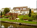


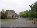
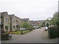
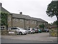

61 photos from this area
Area Information
Key information about the BD20 0EA including its size, population, and administrative classification.
- Area Type
- Postcode
- Area Size
- 2.6 hectares
- Population
- 1996
- Population Density
- 2034 people/km²
House Prices in BD20 0EA
30
Properties
£130,048
Average Sold Price
£77,333
Lowest Price
£190,000
Highest Price
Showing 30 properties
| Address | Type | Beds | Baths | Last Sale Price | Last Sale Date | |
|---|---|---|---|---|---|---|
| Shires Rest, Keighley Road, Silsden, Keighley, BD20 0EA | Detached | 2 | - | £128,000 | Jul 2024 | |
| 46 Keighley Road, Silsden, Keighley, BD20 0EA | house | - | - | £125,000 | Jan 2022 | |
| 58 Keighley Road, Silsden, Keighley, BD20 0EA | Terraced | 3 | 1 | £190,000 | Aug 2021 | |
| 38 Keighley Road, Silsden, Keighley, BD20 0EA | Industrial | - | - | £155,000 | May 2021 | |
| 40 Keighley Road, Silsden, Keighley, BD20 0EA | house | 2 | - | £90,000 | Dec 2020 | |
| 62 Keighley Road, Silsden, Keighley, BD20 0EA | house | 3 | 1 | £145,000 | Aug 2019 | |
| 54 Keighley Road, Silsden, Keighley, BD20 0EA | house | 3 | - | £77,333 | Jun 2002 | |
| 36 Keighley Road, Silsden, Keighley, BD20 0EA | Terraced | 2 | 1 | - | - | |
| Former 42 To 44, Keighley Road, Silsden, Keighley, BD20 0EA | Terraced | - | - | - | - | |
| Flat At, Bridge Inn, 62 Keighley Road, Silsden, Keighley, BD20 0EA | Flat | - | - | - | - |
Page 1 of 3
Energy Efficiency in BD20 0EA
Amenities
Schools
| Rank | School | Type | Entry gender | Ages |
|---|
Explore more schools in this area
Go to Schools tabDemographics
Household Size
One person
most common
Accommodation Type
Houses
most common
Tenure
66
majority
Ethnic Group
White
most common
Religion
N/A
most common
Household Composition
N/A
most common
Age
47
median
Adults (30-64 years)
most common
Household Deprivation
N/A
with no deprivation
NS-SEC
35
in Lower managerial occupations
Explore more demographic insights in this area
Go to Demographics tabPlanning
Planning Constraints
- Flood RiskPremium
- Ramsar Wetland SitesPremium
- Area of Outstanding Natural BeautyPremium
- Protected Nature ReservePremium
- Protected WoodlandPremium