Area Overview for BD20 0HD
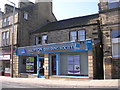
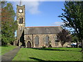
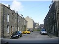
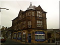
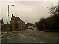
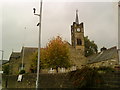
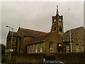
Photos of BD20 0HD
Area Information
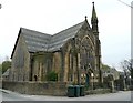
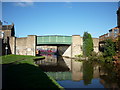
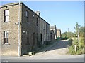
Living in BD20 0HD means inhabiting a tightly packed residential cluster in West Yorkshire, where the population of 1,996 is spread across just 864 square metres. This density creates a compact, community-focused environment, though it also reflects the area’s historical roots as a small agricultural estate mentioned in the 1086 Domesday Book. Silsden, the town encompassing this postcode, retains echoes of its past as a hub for canal transport and nail-making industries. Today, the area is defined by its mix of historic architecture, including a 1610 estate map and Grade II listed buildings, and modern convenience. Residents benefit from proximity to rail networks, with stations like Steeton & Silsden and Keighley offering links to larger cities. The median age of 47 suggests a stable, established community, with many households owning their homes. Daily life here balances quiet residential charm with practical access to retail, transport, and green spaces, though the area’s small size means every decision about living here is shaped by its limited footprint.
- Area Type
- Postcode
- Area Size
- 864 m²
- Population
- 1996
- Population Density
- 2034 people/km²
The property market in BD20 0HD is characterised by high home ownership (66%) and a focus on houses, which dominate the accommodation type. This suggests a market skewed toward owner-occupied properties rather than rental units, though the small area size means the housing stock is limited. The concentration of houses may reflect the area’s historic development patterns, where larger plots were available for single-family homes. For buyers, this means competition for properties is likely fierce, given the scarcity of new builds in such a compact postcode. The immediate surroundings may offer similar housing types, but the lack of data on specific property listings or price ranges means buyers must consider the broader Silsden area for options. The high home ownership rate also implies a community with long-term residents, which could influence property values and local dynamics.
House Prices in BD20 0HD
Showing 1 properties
| Address | Type | Beds | Baths | Last Sale Price | Last Sale Date | |
|---|---|---|---|---|---|---|
| Watsons Heating Engineers, Watson House, Howden Road, Silsden, Keighley, BD20 0HD | Office | - | - | - | - |
Energy Efficiency in BD20 0HD
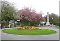
Residents of BD20 0HD have access to a range of amenities within practical reach, including retail options like Aldi Silsden and Co-op Silsden, which cater to everyday needs. The area’s transport links to rail and metro stations—such as Steeton & Silsden and Bolton Abbey—connect it to broader networks for shopping, leisure, and employment. While the data does not specify parks or recreational spaces, the nearby Silsden Conservation Area, with its 63 listed buildings and historic sites like the 18th-century St James Church, offers cultural and architectural interest. The compact nature of the area means amenities are closely clustered, reducing travel time for errands or socialising. However, the absence of detailed information on dining or leisure venues leaves some aspects of daily life undefined, though the existing infrastructure suggests a functional, if modest, lifestyle.
Amenities
Schools
| Rank | School | Type | Entry gender | Ages |
|---|
Explore more schools in this area
Go to Schools tabDemographics
BD20 0HD’s population of 1,996 is predominantly adults aged 30-64, with a median age of 47. This suggests a mature, settled community, likely with strong family ties and long-term residency. Home ownership is high at 66%, with houses being the primary accommodation type, indicating a preference for private, permanent living rather than rental properties. The predominant ethnic group is White, reflecting the area’s historical and cultural continuity. The population density of 2,310,824 people per square kilometre is exceptionally high, which, while offering a tightly knit community, may also mean limited space for expansion or new developments. This density, combined with the age profile, implies a stable demographic with minimal turnover, where local amenities and social networks are likely well-established. However, the lack of diversity data means the full picture of community composition remains partially obscured.
Household Size
Accommodation Type
Tenure
Ethnic Group
Religion
Household Composition
Age
Household Deprivation
NS-SEC
Explore more demographic insights in this area
Go to Demographics tabPlanning
Planning Constraints
- Flood RiskPremium
- Ramsar Wetland SitesPremium
- Area of Outstanding Natural BeautyPremium
- Protected Nature ReservePremium
- Protected WoodlandPremium