Area Overview for BD20 0NB
Photos of BD20 0NB

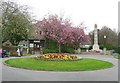

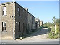


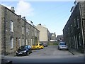
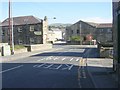


100 photos from this area
Area Information
Key information about the BD20 0NB including its size, population, and administrative classification.
- Area Type
- Postcode
- Area Size
- 8447 m²
- Population
- 1996
- Population Density
- 2034 people/km²
House Prices in BD20 0NB
24
Properties
£208,121
Average Sold Price
£144,700
Lowest Price
£330,000
Highest Price
Showing 24 properties
| Address | Type | Beds | Baths | Last Sale Price | Last Sale Date | |
|---|---|---|---|---|---|---|
| 38 Hainsworth Road, Silsden, Keighley, BD20 0NB | house | 3 | 1 | £299,950 | Aug 2025 | |
| 20 Hainsworth Road, Silsden, Keighley, BD20 0NB | house | - | - | £266,000 | Oct 2024 | |
| 52 Hainsworth Road, Silsden, Keighley, BD20 0NB | Semi-detached | 4 | 2 | £199,950 | Aug 2024 | |
| 36 Hainsworth Road, Silsden, Keighley, BD20 0NB | house | - | - | £330,000 | Oct 2018 | |
| Millbank, 17 Hainsworth Road, Silsden, Keighley, BD20 0NB | house | 4 | - | £317,000 | Oct 2017 | |
| 24 Hainsworth Road, Silsden, Keighley, BD20 0NB | Terraced | - | - | £200,000 | Jan 2016 | |
| 16 Hainsworth Road, Silsden, Keighley, BD20 0NB | Semi-detached | 4 | 2 | £185,000 | Dec 2015 | |
| 48 Hainsworth Road, Silsden, Keighley, BD20 0NB | Semi-detached | 4 | 2 | £169,950 | Oct 2015 | |
| 50 Hainsworth Road, Silsden, Keighley, BD20 0NB | Semi-detached | 3 | 2 | £165,000 | Jul 2014 | |
| 34 Hainsworth Road, Silsden, Keighley, BD20 0NB | Terraced | - | - | £167,000 | Oct 2007 |
Page 1 of 3
Energy Efficiency in BD20 0NB
Amenities
Schools
| Rank | School | Type | Entry gender | Ages |
|---|
Explore more schools in this area
Go to Schools tabDemographics
Household Size
One person
most common
Accommodation Type
Houses
most common
Tenure
66
majority
Ethnic Group
White
most common
Religion
N/A
most common
Household Composition
N/A
most common
Age
47
median
Adults (30-64 years)
most common
Household Deprivation
N/A
with no deprivation
NS-SEC
35
in Lower managerial occupations
Explore more demographic insights in this area
Go to Demographics tabPlanning
Planning Constraints
- Flood RiskPremium
- Ramsar Wetland SitesPremium
- Area of Outstanding Natural BeautyPremium
- Protected Nature ReservePremium
- Protected WoodlandPremium