Area Overview for BD2 3QQ
Photos of BD2 3QQ
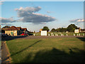
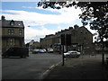

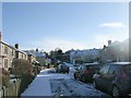
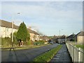
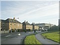
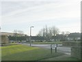
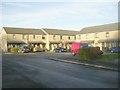
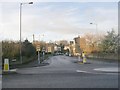
100 photos from this area
Area Information
Key information about the BD2 3QQ including its size, population, and administrative classification.
- Area Type
- Postcode
- Area Size
- 3.4 hectares
- Population
- 1670
- Population Density
- 3497 people/km²
House Prices in BD2 3QQ
27
Properties
£81,291
Average Sold Price
£26,800
Lowest Price
£127,000
Highest Price
Showing 27 properties
| Address | Type | Beds | Baths | Last Sale Price | Last Sale Date | |
|---|---|---|---|---|---|---|
| 101 Foston Lane, Bradford, BD2 3QQ | Retail | 3 | 1 | £127,000 | Oct 2022 | |
| 53 Foston Lane, Bradford, BD2 3QQ | Semi-detached | 3 | - | £87,000 | Feb 2018 | |
| 77 Foston Lane, Bradford, BD2 3QQ | house | 3 | - | £81,900 | Sep 2011 | |
| 73 Foston Lane, Bradford, BD2 3QQ | house | - | - | £70,000 | May 2011 | |
| 63 Foston Lane, Bradford, BD2 3QQ | Semi-detached | - | - | £95,000 | Dec 2008 | |
| 65 Foston Lane, Bradford, BD2 3QQ | Semi-detached | - | - | £95,500 | Apr 2008 | |
| 79 Foston Lane, Bradford, BD2 3QQ | Semi-detached | 3 | - | £106,500 | Jul 2007 | |
| 81 Foston Lane, Bradford, BD2 3QQ | house | - | - | £94,000 | May 2007 | |
| 67 Foston Lane, Bradford, BD2 3QQ | house | - | - | £71,500 | Nov 2005 | |
| 97 Foston Lane, Bradford, BD2 3QQ | house | - | - | £26,800 | Jul 2002 |
Page 1 of 3
Energy Efficiency in BD2 3QQ
Amenities
Schools
| Rank | School | Type | Entry gender | Ages |
|---|
Explore more schools in this area
Go to Schools tabDemographics
Household Size
Family (3-5 people)
most common
Accommodation Type
Houses
most common
Tenure
36
majority
Ethnic Group
asian_total
most common
Religion
N/A
most common
Household Composition
N/A
most common
Age
22
median
Adults (30-64 years)
most common
Household Deprivation
N/A
with no deprivation
NS-SEC
12
in Lower managerial occupations
Explore more demographic insights in this area
Go to Demographics tabPlanning
Planning Constraints
- Flood RiskPremium
- Ramsar Wetland SitesPremium
- Area of Outstanding Natural BeautyPremium
- Protected Nature ReservePremium
- Protected WoodlandPremium