Area Overview for BD19 4BZ
Photos of BD19 4BZ
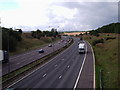


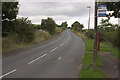
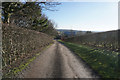
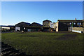
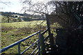

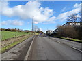
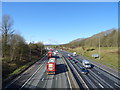

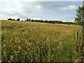
30 photos from this area
Area Information
Key information about the BD19 4BZ including its size, population, and administrative classification.
- Area Type
- Postcode
- Area Size
- 26.6 hectares
- Population
- 1576
- Population Density
- 852 people/km²
House Prices in BD19 4BZ
37
Properties
£367,390
Average Sold Price
£100,000
Lowest Price
£860,000
Highest Price
Showing 37 properties
| Address | Type | Beds | Baths | Last Sale Price | Last Sale Date | |
|---|---|---|---|---|---|---|
| 191 Drub Lane, Drub, Cleckheaton, BD19 4BZ | Detached | 3 | 2 | £440,000 | Nov 2024 | |
| 141 Drub Lane, Drub, Cleckheaton, BD19 4BZ | house | 3 | 3 | £382,500 | Sep 2024 | |
| 109 Drub Lane, Drub, Cleckheaton, BD19 4BZ | house | - | - | £225,000 | Jul 2024 | |
| 87 Drub Lane, Drub, Cleckheaton, BD19 4BZ | Detached | 5 | 4 | £467,500 | Nov 2023 | |
| 81 Drub Lane, Drub, Cleckheaton, BD19 4BZ | Detached | 6 | - | £860,000 | Jan 2022 | |
| 123 Drub Lane, Drub, Cleckheaton, BD19 4BZ | Bungalow | 3 | 2 | £399,950 | Dec 2021 | |
| 121 Drub Lane, Drub, Cleckheaton, BD19 4BZ | Detached | 3 | 2 | £307,000 | Aug 2021 | |
| 229 Drub Lane, Drub, Cleckheaton, BD19 4BZ | Semi-detached | 3 | 1 | £267,500 | Jul 2018 | |
| 195 Drub Lane, Drub, Cleckheaton, BD19 4BZ | Bungalow | - | - | £560,000 | Jan 2018 | |
| 113 Drub Lane, Drub, Cleckheaton, BD19 4BZ | Semi-detached | 3 | - | £180,000 | Mar 2017 |
Page 1 of 4
Energy Efficiency in BD19 4BZ
Amenities
Schools
| Rank | School | Type | Entry gender | Ages |
|---|
Explore more schools in this area
Go to Schools tabDemographics
Household Size
Two person
most common
Accommodation Type
Houses
most common
Tenure
85
majority
Ethnic Group
White
most common
Religion
N/A
most common
Household Composition
N/A
most common
Age
47
median
Adults (30-64 years)
most common
Household Deprivation
N/A
with no deprivation
NS-SEC
35
in Lower managerial occupations
Explore more demographic insights in this area
Go to Demographics tabPlanning
Planning Constraints
- Flood RiskPremium
- Ramsar Wetland SitesPremium
- Area of Outstanding Natural BeautyPremium
- Protected Nature ReservePremium
- Protected WoodlandPremium