Area Overview for BD17 7TW
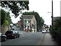
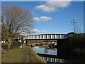
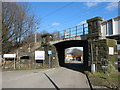
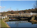
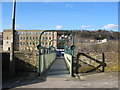
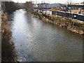
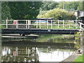
Photos of BD17 7TW

Area Information
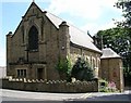
Living in BD17 7TW means inhabiting a small, densely populated residential cluster in England’s West Riding of Yorkshire. The area covers just 285 square metres, yet it hosts 1,945 residents, creating a tightly knit community with a population density of over 6.8 million people per square kilometre. This postcode is part of Baildon, a historic town with roots in prehistoric activity and 18th-century textile industry. Today, it blends rural moorland edges with modern amenities, offering a picturesque countryside atmosphere near Bradford and Shipley. The median age of 47 suggests a mature demographic, with adults aged 30–64 forming the largest group. While the area is predominantly owner-occupied (54%), its compact size means residents are likely to know their neighbours. Daily life here balances suburban convenience with proximity to natural landscapes, though the high population density may influence the pace of living. For those seeking a quiet, historic setting with easy access to nearby cities, BD17 7TW presents a distinctive mix of heritage and contemporary living.
- Area Type
- Postcode
- Area Size
- 285 m²
- Population
- 1945
- Population Density
- 3663 people/km²
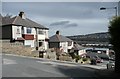
The property market in BD17 7TW is characterised by a 54% home ownership rate, with houses forming the predominant accommodation type. This suggests a focus on owner-occupied properties, likely appealing to families or long-term residents. Given the area’s small size and high population density, the housing stock is likely limited, with properties concentrated in a compact residential cluster. The presence of houses rather than flats or apartments may indicate a preference for traditional, spacious homes, which could be a draw for buyers seeking family-friendly living. However, the small area means that the immediate surroundings may offer limited housing diversity. Buyers should consider the potential for competition in the local market, as well as the need for proximity to nearby towns like Shipley or Bradford for additional property options. The high ownership rate also implies a relatively stable market, with fewer rental properties available.
House Prices in BD17 7TW
No properties found in this postcode.
Energy Efficiency in BD17 7TW
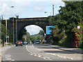
Residents of BD17 7TW have access to a range of amenities within practical reach, including retail options like Tesco Baildon, Aldi Windhill, and Lidl Shipley. These stores provide everyday shopping convenience, reducing the need to travel further for essentials. The area’s rail links to Shipley, Baildon, and Saltaire stations connect residents to nearby towns, while proximity to major roads ensures easy access to larger cities. Two airports are within reach, adding to the area’s transport versatility. Though the data does not list parks or leisure facilities explicitly, the historical context of Baildon suggests nearby natural spaces like Baildon Moor, which may offer recreational opportunities. The combination of retail, transport, and potential green spaces creates a lifestyle that balances suburban comfort with access to broader regional amenities.
Amenities
Schools
The nearest school to BD17 7TW is Ferniehurst First School, a primary institution. No secondary schools are listed in the data, so families may need to look beyond the immediate area for secondary education. The presence of a primary school suggests that the area is well-served for younger children, though parents of older students might find it necessary to travel to nearby towns like Shipley or Bradford. The lack of secondary schools in the immediate vicinity could be a consideration for families planning long-term residency. Ferniehurst First School’s role as a primary institution indicates a focus on early education, but the absence of a broader school network may require additional planning for secondary schooling.
| Rank | School | Type | Entry gender | Ages |
|---|
Explore more schools in this area
Go to Schools tabDemographics
The community in BD17 7TW is predominantly composed of adults aged 30–64, with a median age of 47. This suggests a mature, established population, likely with long-term ties to the area. Home ownership sits at 54%, indicating a mix of owner-occupied and rental properties, though the exact rental proportion is not specified. The accommodation type is primarily houses, which may reflect a preference for larger, family-friendly living spaces. The predominant ethnic group is White, though specific diversity figures are not provided. The population density of 6.8 million per square kilometre is exceptionally high, which may impact local infrastructure and community dynamics. While this density could foster a strong sense of community, it may also contribute to challenges in housing availability or public services. The data does not indicate deprivation levels, but the high ownership rate and mature age profile suggest a stable, long-term resident base.
Household Size
Accommodation Type
Tenure
Ethnic Group
Religion
Household Composition
Age
Household Deprivation
NS-SEC
Explore more demographic insights in this area
Go to Demographics tabPlanning
Planning Constraints
- Flood RiskPremium
- Ramsar Wetland SitesPremium
- Area of Outstanding Natural BeautyPremium
- Protected Nature ReservePremium
- Protected WoodlandPremium