Area Overview for BD17 7LW
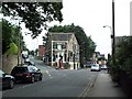
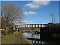
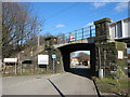
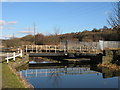
Photos of BD17 7LW
Area Information
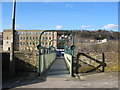
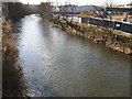
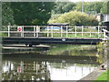
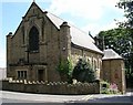
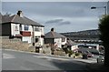
Living in BD17 7LW means inhabiting a compact, densely populated residential cluster in the heart of Baildon, a historic town in West Yorkshire. The area covers just 2.1 hectares, yet it accommodates 1,945 residents, resulting in a population density of 90,796 people per square kilometre. This small postcode area blends suburban convenience with rural character, situated on Baildon Moor, a landscape marked by prehistoric artefacts and dramatic moorland vistas. The community is predominantly composed of adults aged 30–64, with a median age of 47, reflecting a mature demographic. Daily life here is shaped by proximity to nearby towns like Shipley and Bradford, with easy access to rail networks, motorways, and retail hubs. The area’s compact size means residents are likely to know their neighbours, though the high density could influence the pace of life. For those seeking a balance between historic charm and modern amenities, BD17 7LW offers a unique mix of low-key countryside and commuter accessibility.
- Area Type
- Postcode
- Area Size
- 2.1 hectares
- Population
- 1945
- Population Density
- 3663 people/km²
The property market in BD17 7LW is characterised by a 54% home ownership rate, indicating that nearly half of properties are owner-occupied, while the remaining are likely rented. The accommodation type is predominantly houses, which aligns with the area’s suburban and rural character, offering larger living spaces compared to flats or apartments. This suggests a market skewed towards family homes, with potential for long-term investment. However, the small area size—just 2.1 hectares—means the housing stock is limited, which could drive competition among buyers. The high population density (90,796 people per square kilometre) may also influence property values, with proximity to amenities like schools, rail links, and retail centres adding to desirability. For buyers, this small area’s immediate surroundings are key, as the local housing supply is constrained, requiring careful consideration of nearby developments or alternative areas within commuting distance.
House Prices in BD17 7LW
No properties found in this postcode.
Energy Efficiency in BD17 7LW
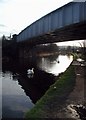
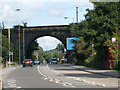
The lifestyle in BD17 7LW is shaped by its proximity to a range of amenities, from retail to transport. Within practical reach are five retail outlets, including major supermarkets like Tesco Baildon and Lidl Shipley, ensuring everyday shopping needs are met. The area’s rail network is extensive, with five stations—including Shipley and Saltaire—offering frequent services to nearby towns and cities. For air travel, Leeds Bradford Airport is just 15 minutes away, while the Ingrow West metro station provides additional connectivity. The surrounding landscape includes Baildon Moor, a historic site with prehistoric artefacts, offering recreational opportunities for nature enthusiasts. The mix of retail, transport, and natural spaces creates a balanced lifestyle, blending suburban convenience with access to rural scenery. However, the compact size of the area means residents may need to venture slightly further for specialist services or larger leisure facilities.
Amenities
Schools
The nearest school to BD17 7LW is Ferniehurst First School, a primary school serving the local community. No specific Ofsted rating is provided in the data, but its presence indicates access to early education for families. The absence of secondary schools in the immediate vicinity means parents may need to consider nearby towns like Shipley or Bradford for secondary education. The availability of a primary school within practical reach is a practical advantage for families, reducing the need for long commutes. However, the lack of higher-tier educational institutions nearby could be a limitation for those prioritising a comprehensive school network. The single primary school suggests a modest educational infrastructure, which may influence family decisions about settling in the area.
| Rank | School | Type | Entry gender | Ages |
|---|
Explore more schools in this area
Go to Schools tabDemographics
The population of BD17 7LW is 1,945, with a median age of 47 and the majority of residents falling within the 30–64 age range. This suggests a community skewed towards middle-aged adults, likely with established careers and families. Home ownership is high at 54%, indicating a stable, long-term resident base, though the remaining 46% may include renters or those in transient housing. The predominant accommodation type is houses, reflecting a residential area with larger properties rather than flats or apartments. The predominant ethnic group is White, with no specific data on other demographics. The high population density—90,796 people per square kilometre—implies a tightly packed community, which could foster strong local ties but may also strain shared resources. This density, combined with the age profile, suggests a mature, settled population with potential for intergenerational living arrangements.
Household Size
Accommodation Type
Tenure
Ethnic Group
Religion
Household Composition
Age
Household Deprivation
NS-SEC
Explore more demographic insights in this area
Go to Demographics tabPlanning
Planning Constraints
- Flood RiskPremium
- Ramsar Wetland SitesPremium
- Area of Outstanding Natural BeautyPremium
- Protected Nature ReservePremium
- Protected WoodlandPremium