Area Overview for BD12 0UF
Photos of BD12 0UF
Area Information
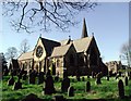
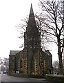
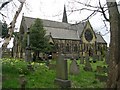
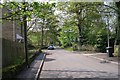
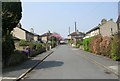
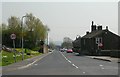
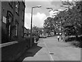
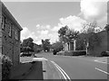
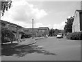
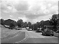
Living in BD12 0UF means inhabiting a tightly knit residential cluster in West Yorkshire, just 4.5 miles south of Bradford city centre. This small area, spanning 1.8 hectares, is home to 1,324 people, making it one of the most densely populated postcode areas in England. Its history dates back to the Norman Conquest, with a settlement evolving around Lower Wyke Lane by the 17th century. Today, the area retains a rural character, defined by well-spaced farmsteads and listed buildings, including a Moravian church and former boarding school. The community is predominantly middle-aged, with a median age of 47, and 76% of residents owning their homes. Daily life is shaped by proximity to retail hubs like Tesco Low and Co-op Wibsey, as well as rail connections to Bradford and beyond. Despite its compact size, BD12 0UF offers a blend of historical charm and modern convenience, with broadband rated at 100/100 and mobile coverage scoring 85/100. It is a place where heritage meets practicality, ideal for those seeking a stable, community-focused lifestyle.
- Area Type
- Postcode
- Area Size
- 1.8 hectares
- Population
- 1324
- Population Density
- 75511 people/km²
The property market in BD12 0UF is characterised by high home ownership (76%) and a predominance of houses over flats, reflecting a traditional, family-oriented housing stock. This suggests a market skewed towards owner-occupation rather than rental, with limited availability of leasehold properties. The compact size of the area—just 1.8 hectares—means the housing stock is finite, potentially limiting new development. For buyers, this implies a focus on existing properties, many of which may be older, given the area’s historical roots. The presence of listed buildings and conservation area status adds unique value but may also impose restrictions on modifications. Given the high population density, properties are likely in close proximity to one another, offering convenience but less privacy. Buyers should consider the area’s small footprint and the potential for limited future growth when evaluating long-term investment.
House Prices in BD12 0UF
Showing 1 properties
| Address | Type | Beds | Baths | Last Sale Price | Last Sale Date | |
|---|---|---|---|---|---|---|
| Aynsley House, Common Road, Bradford, BD12 0UF | Office | - | - | - | - |
Energy Efficiency in BD12 0UF
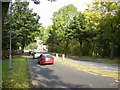
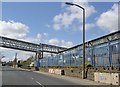
Daily life in BD12 0UF is enriched by nearby amenities, including five retail outlets such as Tesco Low, Co-op Wibsey, and Morrisons Bankfoot, offering convenience for shopping and daily needs. The area’s character is defined by its conservation status, with listed buildings like the Moravian church and former boarding school adding historical depth. The rural feel persists despite surrounding industrial activity, with well-spaced homes and green spaces. Residents can access rail stations like Low Moor and Bradford Interchange, facilitating travel to Bradford and other destinations. The proximity to these amenities, combined with the area’s preserved heritage, creates a lifestyle that balances practicality with a sense of place. The compact layout ensures that essentials are never far, while the historical architecture offers a unique visual and cultural backdrop.
Amenities
Schools
The nearest school to BD12 0UF is Low Moor CofE Primary School, which holds a ‘good’ Ofsted rating. This school serves the local community with primary education, though no secondary schools are listed in the data. Families requiring secondary education may need to look further afield, potentially increasing commuting time. The presence of a well-rated primary school is a significant draw for families, as it suggests quality early education and a commitment to community schooling. However, the lack of secondary options highlights a potential limitation for households with older children. The school’s location within practical reach of residents underscores the area’s suitability for families prioritising accessible education.
| Rank | School | Type | Entry gender | Ages |
|---|
Explore more schools in this area
Go to Schools tabDemographics
BD12 0UF’s population of 1,324 is predominantly composed of adults aged 30–64, with a median age of 47. This suggests a mature, established community, likely with strong family ties and long-term residency. Home ownership is high at 76%, indicating a stable housing market with fewer rental properties. The area is primarily composed of houses, not flats, reflecting a preference for traditional family homes. The predominant ethnic group is White, though no specific diversity statistics are provided. The high population density—75,511 people per square kilometre—means the area is compact but not overcrowded. This demographic profile suggests a community focused on stability, with residents likely prioritising home ownership and proximity to local amenities. The absence of detailed deprivation data means the quality of life is inferred from infrastructure and services, which appear robust given the broadband and transport scores.
Household Size
Accommodation Type
Tenure
Ethnic Group
Religion
Household Composition
Age
Household Deprivation
NS-SEC
Explore more demographic insights in this area
Go to Demographics tabPlanning
Planning Constraints
- Flood RiskPremium
- Ramsar Wetland SitesPremium
- Area of Outstanding Natural BeautyPremium
- Protected Nature ReservePremium
- Protected WoodlandPremium