Area Overview for Wythall West Ward
Photos of Wythall West Ward
Area Information
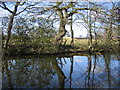
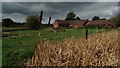
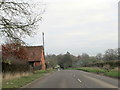
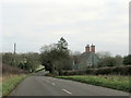
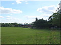
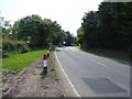
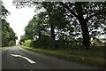
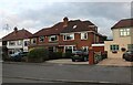
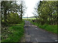
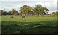
Wythall West Ward sits as an electoral ward within the larger civil parish of Wythall, a substantial village in Bromsgrove District. You will find this area located approximately seven miles south of Birmingham City Centre, nestled in northeastern Worcestershire where it borders both Solihull and Birmingham. The ward covers a total ground area of 12.1 square kilometres, forming part of the parish which recorded a population of 12,269 in the 2021 UK census. Life here moves at a pace dictated by its location along Alcester Road, a route that connects you to the wider region. This neighbourhood has deep historical roots stretching back to 1911 when the remainder of the previous King's Norton civil parish was absorbed into the County Borough of Birmingham. From 1939 to 1959, the site hosted a Royal Air Force station that initially deployed barrage balloons before transitioning into a school for applied linguistics training. Part of this former military site now houses the Transport Museum on Chapel Lane, where you can view historic buses and electric vehicles. The area also features long-standing industrial history, such as Davies Timber Ltd., a sawmill provided continuous employment for over a century. Living in Wythall West Ward offers a connection to these past industries alongside modern convenience, while the presence of the Wythall Institute, erected in 1888 or 1889, adds to the architectural character of the street scene. Homes in this ward benefit from proximity to Stratford-upon-Avon and Kidderminster via train, making it a specific choice for those seeking a village feel with city access.
- Area Type
- District Borough Unitary Ward
- Area Size
- 12.1 km²
- Population
- Not available
- Population Density
- Not available
Demographics
The community within Wythall West Ward is defined by a distinctly mature age profile. The median age of residents is 70, indicating that the population consists largely of older adults. While specific breakdowns by age range are not detailed beyond this median, the high average suggests the neighbourhood functions primarily as a retirement or mature living hub. Most common household types and specific demographic splits are not broken down further in available records, but the overall picture paints a clear social landscape. You are likely to interact with neighbours who have lived here for decades, rather than families with young children moving in frequently. Home ownership stands at an exceptionally high level, with 92 per cent of residents owning their homes outright or with a mortgage. This figure confirms that living in Wythall West Ward is an acquired, long-term commitment for the vast majority of residents rather than a temporary rental arrangement. The area does not display significant diversity in terms of ethnicity, religion, or household composition in the provided data, reinforcing its status as a settled, homogeneous community. Deprivation metrics are absent from the current statistics, preventing a direct comparison with wealthier or poorer wards. However, the combination of high home ownership and an elderly population suggests stability over rapid turnover. If you are considering buying a home here, you join a setting where people have roots rather than transient lifestyles.
Household Size
Accommodation Type
Tenure
Ethnic Group
Religion
Household Composition
Age
Household Deprivation
NS-SEC
Explore more demographic insights in this area
Go to Demographics tabPlanning
Planning Constraints
- Flood RiskPremium
- Ramsar Wetland SitesPremium
- Area of Outstanding Natural BeautyPremium
- Protected Nature ReservePremium
- Protected WoodlandPremium