Area Overview for WV8 1EH
Photos of WV8 1EH


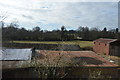
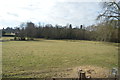
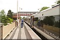
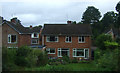
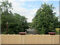
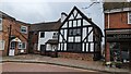
47 photos from this area
Area Information
Key information about the WV8 1EH including its size, population, and administrative classification.
- Area Type
- Postcode
- Area Size
- 1.7 hectares
- Population
- 1645
- Population Density
- 3352 people/km²
House Prices in WV8 1EH
18
Properties
£484,125
Average Sold Price
£90,000
Lowest Price
£1,040,000
Highest Price
Showing 18 properties
| Address | Type | Beds | Baths | Last Sale Price | Last Sale Date | |
|---|---|---|---|---|---|---|
| Vine Cottage, 36-38 Church Road, Codsall, WV8 1EH | Detached | 3 | 2 | £476,000 | May 2024 | |
| 40 Church Road, Codsall, WV8 1EH | Cottage | 2 | 1 | £247,000 | Jan 2023 | |
| 63 Church Road, Codsall, WV8 1EH | house | - | - | £370,000 | Oct 2022 | |
| The Old Vicarage, 52 Church Road, Codsall, WV8 1EH | house | - | - | £1,040,000 | Jan 2022 | |
| 30 Church Road, Codsall, WV8 1EH | house | - | - | £950,000 | Aug 2020 | |
| Belleterre, 46 Church Road, Codsall, WV8 1EH | house | - | - | £535,000 | Oct 2017 | |
| 61 Church Road, Codsall, WV8 1EH | Semi-detached | - | - | £165,000 | Feb 2003 | |
| 59 Church Road, Codsall, WV8 1EH | Semi-detached | - | - | £90,000 | Nov 2000 | |
| Old Drury Corner, Church Road, Codsall, WV8 1EH | Detached | - | - | - | - | |
| The Coach House, Church Road, Codsall, WV8 1EH | Detached | - | - | - | - |
Page 1 of 2
Energy Efficiency in WV8 1EH
Amenities
Schools
| Rank | School | Type | Entry gender | Ages |
|---|
Explore more schools in this area
Go to Schools tabDemographics
Household Size
Family (3-5 people)
most common
Accommodation Type
Houses
most common
Tenure
90
majority
Ethnic Group
White
most common
Religion
N/A
most common
Household Composition
N/A
most common
Age
47
median
Adults (30-64 years)
most common
Household Deprivation
N/A
with no deprivation
NS-SEC
48
in Lower managerial occupations
Explore more demographic insights in this area
Go to Demographics tabPlanning
Planning Constraints
- Flood RiskPremium
- Ramsar Wetland SitesPremium
- Area of Outstanding Natural BeautyPremium
- Protected Nature ReservePremium
- Protected WoodlandPremium