Area Overview for WV7 3JH
Photos of WV7 3JH


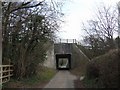

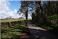
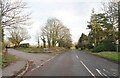
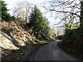


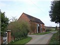
19 photos from this area
Area Information
Key information about the WV7 3JH including its size, population, and administrative classification.
- Area Type
- Postcode
- Area Size
- 33.2 hectares
- Population
- 1931
- Population Density
- 148 people/km²
House Prices in WV7 3JH
14
Properties
£516,000
Average Sold Price
£135,000
Lowest Price
£725,000
Highest Price
Showing 14 properties
| Address | Type | Beds | Baths | Last Sale Price | Last Sale Date | |
|---|---|---|---|---|---|---|
| Pebble Brook, Kingswood Road, Albrighton, WV7 3JH | house | - | - | £545,000 | Aug 2020 | |
| Brook House, Kingswood Road, Albrighton, WV7 3JH | house | - | - | £725,000 | Dec 2017 | |
| The Cedars, Kingswood Road, Albrighton, WV7 3JH | Retirement | - | - | £500,000 | Dec 2017 | |
| Witherford, Kingswood Road, Albrighton, WV7 3JH | house | 5 | 3 | £675,000 | Aug 2010 | |
| The Cottage, Kingswood Road, Albrighton, WV7 3JH | house | 4 | - | £135,000 | Nov 1997 | |
| The Stannels, Kingswood Road, Albrighton, WV7 3JH | Cottage | 3 | 2 | - | - | |
| Stannells, Kingswood Road, Albrighton, WV7 3JH | Detached | - | - | - | - | |
| Jade Shop & Store Fitters Ltd., Business Unit, Kingswood Road Nurseries, Kingswood Road, Albrighton, WV7 3JH | Industrial | - | - | - | - | |
| White Hays, Kingswood Road, Albrighton, WV7 3JH | Detached | - | - | - | - | |
| Glen Dene, Kingswood Road, Albrighton, WV7 3JH | house | - | - | - | - |
Page 1 of 2
Energy Efficiency in WV7 3JH
Amenities
Schools
| Rank | School | Type | Entry gender | Ages |
|---|
Explore more schools in this area
Go to Schools tabDemographics
Household Size
Two person
most common
Accommodation Type
Houses
most common
Tenure
85
majority
Ethnic Group
White
most common
Religion
N/A
most common
Household Composition
N/A
most common
Age
47
median
Adults (30-64 years)
most common
Household Deprivation
N/A
with no deprivation
NS-SEC
44
in Lower managerial occupations
Explore more demographic insights in this area
Go to Demographics tabPlanning
Planning Constraints
- Flood RiskPremium
- Ramsar Wetland SitesPremium
- Area of Outstanding Natural BeautyPremium
- Protected Nature ReservePremium
- Protected WoodlandPremium