Area Overview for WV6 9HL
Photos of WV6 9HL
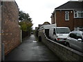
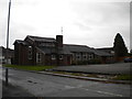
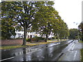
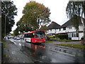
99 photos from this area
Area Information
Key information about the WV6 9HL including its size, population, and administrative classification.
- Area Type
- Postcode
- Area Size
- 1.0 hectares
- Population
- 1681
- Population Density
- 4119 people/km²
House Prices in WV6 9HL
22
Properties
£149,746
Average Sold Price
£45,350
Lowest Price
£270,000
Highest Price
Showing 22 properties
| Address | Type | Beds | Baths | Last Sale Price | Last Sale Date | |
|---|---|---|---|---|---|---|
| 89 Green Lane, Wolverhampton, WV6 9HL | house | 3 | 1 | £270,000 | Aug 2024 | |
| 83 Green Lane, Wolverhampton, WV6 9HL | Semi-detached | 3 | 1 | £203,100 | Sep 2021 | |
| 60 Green Lane, Wolverhampton, WV6 9HL | Semi-detached | 3 | 1 | £159,000 | Apr 2018 | |
| 67 Green Lane, Wolverhampton, WV6 9HL | Semi-detached | 3 | 1 | £122,500 | May 2016 | |
| 75 Green Lane, Wolverhampton, WV6 9HL | Semi-detached | 2 | - | £168,000 | Jan 2016 | |
| 81 Green Lane, Wolverhampton, WV6 9HL | Semi-detached | 3 | 1 | £145,000 | Oct 2015 | |
| 97 Green Lane, Wolverhampton, WV6 9HL | house | - | - | £141,000 | Feb 2015 | |
| 95 Green Lane, Wolverhampton, WV6 9HL | house | - | - | £154,000 | Oct 2007 | |
| 66 Green Lane, Wolverhampton, WV6 9HL | house | - | - | £165,000 | Sep 2007 | |
| 69 Green Lane, Wolverhampton, WV6 9HL | Detached | 3 | 1 | £155,000 | Jun 2007 |
Page 1 of 3
Energy Efficiency in WV6 9HL
Amenities
Schools
| Rank | School | Type | Entry gender | Ages |
|---|
Explore more schools in this area
Go to Schools tabDemographics
Household Size
Family (3-5 people)
most common
Accommodation Type
Houses
most common
Tenure
81
majority
Ethnic Group
White
most common
Religion
N/A
most common
Household Composition
N/A
most common
Age
47
median
Adults (30-64 years)
most common
Household Deprivation
N/A
with no deprivation
NS-SEC
32
in Lower managerial occupations
Explore more demographic insights in this area
Go to Demographics tabPlanning
Planning Constraints
- Flood RiskPremium
- Ramsar Wetland SitesPremium
- Area of Outstanding Natural BeautyPremium
- Protected Nature ReservePremium
- Protected WoodlandPremium