Area Overview for WV6 8LB
Photos of WV6 8LB
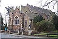
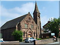
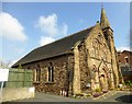
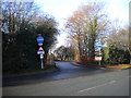
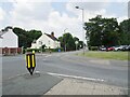
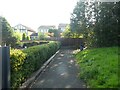
100 photos from this area
Area Information
Key information about the WV6 8LB including its size, population, and administrative classification.
- Area Type
- Postcode
- Area Size
- 6117 m²
- Population
- 1518
- Population Density
- 4603 people/km²
House Prices in WV6 8LB
17
Properties
£142,369
Average Sold Price
£36,000
Lowest Price
£230,000
Highest Price
Showing 17 properties
| Address | Type | Beds | Baths | Last Sale Price | Last Sale Date | |
|---|---|---|---|---|---|---|
| 55 The Crescent, Tettenhall Wood, Wolverhampton, WV6 8LB | Semi-detached | 3 | 1 | £230,000 | Jul 2025 | |
| 81 The Crescent, Tettenhall Wood, Wolverhampton, WV6 8LB | Semi-detached | 2 | 1 | £220,000 | Apr 2025 | |
| 77 The Crescent, Tettenhall Wood, Wolverhampton, WV6 8LB | Semi-detached | 3 | 1 | £187,453 | Dec 2022 | |
| 75 The Crescent, Tettenhall Wood, Wolverhampton, WV6 8LB | house | - | - | £182,000 | Apr 2021 | |
| 85 The Crescent, Tettenhall Wood, Wolverhampton, WV6 8LB | Semi-detached | 4 | 1 | £180,000 | Dec 2017 | |
| 59 The Crescent, Tettenhall Wood, Wolverhampton, WV6 8LB | house | - | - | £129,000 | Nov 2016 | |
| 69 The Crescent, Tettenhall Wood, Wolverhampton, WV6 8LB | house | - | - | £134,000 | Nov 2015 | |
| 63 The Crescent, Tettenhall Wood, Wolverhampton, WV6 8LB | Semi-detached | 3 | 1 | £133,000 | May 2012 | |
| 53 The Crescent, Tettenhall Wood, Wolverhampton, WV6 8LB | Semi-detached | 3 | 1 | £98,000 | Apr 2011 | |
| 73 The Crescent, Tettenhall Wood, Wolverhampton, WV6 8LB | Semi-detached | - | - | £142,500 | Feb 2008 |
Page 1 of 2
Energy Efficiency in WV6 8LB
Amenities
Schools
| Rank | School | Type | Entry gender | Ages |
|---|
Explore more schools in this area
Go to Schools tabDemographics
Household Size
Family (3-5 people)
most common
Accommodation Type
Houses
most common
Tenure
76
majority
Ethnic Group
White
most common
Religion
N/A
most common
Household Composition
N/A
most common
Age
47
median
Adults (30-64 years)
most common
Household Deprivation
N/A
with no deprivation
NS-SEC
35
in Lower managerial occupations
Explore more demographic insights in this area
Go to Demographics tabPlanning
Planning Constraints
- Flood RiskPremium
- Ramsar Wetland SitesPremium
- Area of Outstanding Natural BeautyPremium
- Protected Nature ReservePremium
- Protected WoodlandPremium