Area Overview for WV6 7YB
Photos of WV6 7YB
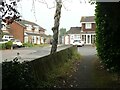
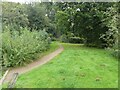
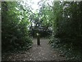
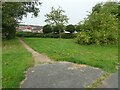
100 photos from this area
Area Information
Key information about the WV6 7YB including its size, population, and administrative classification.
- Area Type
- Postcode
- Area Size
- 46.4 hectares
- Population
- 1916
- Population Density
- 127 people/km²
House Prices in WV6 7YB
40
Properties
£159,492
Average Sold Price
£54,000
Lowest Price
£240,000
Highest Price
Showing 40 properties
| Address | Type | Beds | Baths | Last Sale Price | Last Sale Date | |
|---|---|---|---|---|---|---|
| 22 Stephenson Drive, Perton, WV6 7YB | Semi-detached | 2 | 1 | £200,000 | Nov 2021 | |
| 60 Stephenson Drive, Perton, WV6 7YB | Semi-detached | 2 | 1 | £175,950 | Dec 2020 | |
| 28 Stephenson Drive, Perton, WV6 7YB | house | - | - | £176,950 | Nov 2020 | |
| 30 Stephenson Drive, Perton, WV6 7YB | Semi-detached | 4 | 3 | £235,500 | Jun 2020 | |
| 38 Stephenson Drive, Perton, WV6 7YB | Semi-detached | 3 | 1 | £192,500 | Jan 2020 | |
| 58 Stephenson Drive, Perton, WV6 7YB | Semi-detached | 2 | 1 | £176,000 | Nov 2019 | |
| 24 Stephenson Drive, Perton, WV6 7YB | Semi-detached | 2 | 1 | £167,000 | Mar 2019 | |
| 10 Stephenson Drive, Perton, WV6 7YB | Detached | 4 | 1 | £240,000 | Jul 2018 | |
| 64 Stephenson Drive, Perton, WV6 7YB | Semi-detached | 3 | 1 | £187,000 | Jul 2018 | |
| 2 Stephenson Drive, Perton, WV6 7YB | Detached | 4 | 2 | £225,000 | Apr 2018 |
Page 1 of 4
Energy Efficiency in WV6 7YB
Amenities
Schools
| Rank | School | Type | Entry gender | Ages |
|---|
Explore more schools in this area
Go to Schools tabDemographics
Household Size
Two person
most common
Accommodation Type
Houses
most common
Tenure
87
majority
Ethnic Group
White
most common
Religion
N/A
most common
Household Composition
N/A
most common
Age
47
median
Adults (30-64 years)
most common
Household Deprivation
N/A
with no deprivation
NS-SEC
37
in Lower managerial occupations
Explore more demographic insights in this area
Go to Demographics tabPlanning
Planning Constraints
- Flood RiskPremium
- Ramsar Wetland SitesPremium
- Area of Outstanding Natural BeautyPremium
- Protected Nature ReservePremium
- Protected WoodlandPremium