Area Overview for WV6 7XP
Photos of WV6 7XP
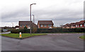
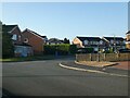
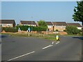
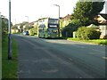
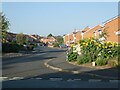
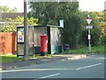
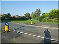
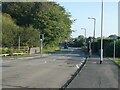
77 photos from this area
Area Information
Key information about the WV6 7XP including its size, population, and administrative classification.
- Area Type
- Postcode
- Area Size
- 1.2 hectares
- Population
- 1392
- Population Density
- 5647 people/km²
House Prices in WV6 7XP
25
Properties
£240,869
Average Sold Price
£72,950
Lowest Price
£385,000
Highest Price
Showing 25 properties
| Address | Type | Beds | Baths | Last Sale Price | Last Sale Date | |
|---|---|---|---|---|---|---|
| 24 The Wheatlands, Perton, WV6 7XP | Detached | 4 | 2 | £380,000 | Nov 2025 | |
| 3 The Wheatlands, Perton, WV6 7XP | Detached | 3 | 1 | £360,000 | Jun 2025 | |
| 10 The Wheatlands, Perton, WV6 7XP | Detached | 4 | 1 | £365,000 | Mar 2025 | |
| 6 The Wheatlands, Perton, WV6 7XP | Detached | 4 | - | £385,000 | Jan 2025 | |
| 17 The Wheatlands, Perton, WV6 7XP | Detached | 3 | 2 | £320,000 | Jun 2022 | |
| 4 The Wheatlands, Perton, WV6 7XP | Detached | 4 | 2 | £307,500 | Jul 2019 | |
| 7 The Wheatlands, Perton, WV6 7XP | Detached | 4 | 2 | £251,000 | Apr 2018 | |
| 2 The Wheatlands, Perton, WV6 7XP | Detached | 4 | 2 | £218,500 | Jan 2016 | |
| 28 The Wheatlands, Perton, WV6 7XP | house | 4 | - | £220,000 | Oct 2011 | |
| 21 The Wheatlands, Perton, WV6 7XP | house | - | - | £185,000 | Oct 2006 |
Page 1 of 3
Energy Efficiency in WV6 7XP
Amenities
Schools
| Rank | School | Type | Entry gender | Ages |
|---|
Explore more schools in this area
Go to Schools tabDemographics
Household Size
Two person
most common
Accommodation Type
Houses
most common
Tenure
82
majority
Ethnic Group
White
most common
Religion
N/A
most common
Household Composition
N/A
most common
Age
47
median
Adults (30-64 years)
most common
Household Deprivation
N/A
with no deprivation
NS-SEC
42
in Lower managerial occupations
Explore more demographic insights in this area
Go to Demographics tabPlanning
Planning Constraints
- Flood RiskPremium
- Ramsar Wetland SitesPremium
- Area of Outstanding Natural BeautyPremium
- Protected Nature ReservePremium
- Protected WoodlandPremium