Area Overview for WV6 7QR
Photos of WV6 7QR
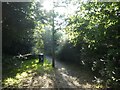
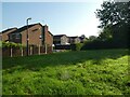

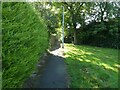
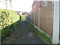
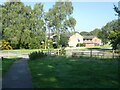
100 photos from this area
Area Information
Key information about the WV6 7QR including its size, population, and administrative classification.
- Area Type
- Postcode
- Area Size
- 8175 m²
- Population
- 1452
- Population Density
- 5040 people/km²
House Prices in WV6 7QR
29
Properties
£119,813
Average Sold Price
£53,500
Lowest Price
£200,000
Highest Price
Showing 29 properties
| Address | Type | Beds | Baths | Last Sale Price | Last Sale Date | |
|---|---|---|---|---|---|---|
| 22 Churnet Grove, Perton, WV6 7QR | house | - | - | £200,000 | Oct 2022 | |
| 10 Churnet Grove, Perton, WV6 7QR | house | - | - | £142,000 | Sep 2021 | |
| 31 Churnet Grove, Perton, WV6 7QR | house | 3 | - | £159,500 | Jan 2021 | |
| 27 Churnet Grove, Perton, WV6 7QR | Terraced | 3 | 1 | £154,000 | Jul 2018 | |
| 57 Churnet Grove, Perton, WV6 7QR | Flat | - | - | £79,500 | Jan 2010 | |
| 18 Churnet Grove, Perton, WV6 7QR | Terraced | - | - | £105,000 | Jul 2005 | |
| 25 Churnet Grove, Perton, WV6 7QR | house | - | - | £65,000 | Nov 2001 | |
| 16 Churnet Grove, Perton, WV6 7QR | house | - | - | £53,500 | Dec 2000 | |
| 23 Churnet Grove, Perton, WV6 7QR | Flat | - | - | - | - | |
| 41 Churnet Grove, Perton, WV6 7QR | Maisonette | - | - | - | - |
Page 1 of 3
Energy Efficiency in WV6 7QR
Amenities
Schools
| Rank | School | Type | Entry gender | Ages |
|---|
Explore more schools in this area
Go to Schools tabDemographics
Household Size
One person
most common
Accommodation Type
Houses
most common
Tenure
32
majority
Ethnic Group
White
most common
Religion
N/A
most common
Household Composition
N/A
most common
Age
47
median
Adults (30-64 years)
most common
Household Deprivation
N/A
with no deprivation
NS-SEC
22
in Lower managerial occupations
Explore more demographic insights in this area
Go to Demographics tabPlanning
Planning Constraints
- Flood RiskPremium
- Ramsar Wetland SitesPremium
- Area of Outstanding Natural BeautyPremium
- Protected Nature ReservePremium
- Protected WoodlandPremium