Area Overview for WV6 7HY
Photos of WV6 7HY
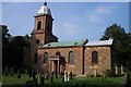
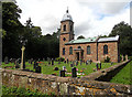
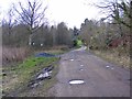
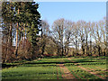
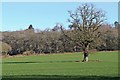
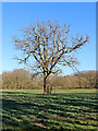
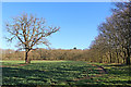
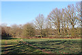
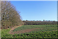
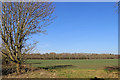
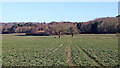
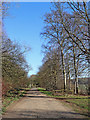
42 photos from this area
Area Information
Key information about the WV6 7HY including its size, population, and administrative classification.
- Area Type
- Postcode
- Area Size
- 62.8 hectares
- Population
- 2261
- Population Density
- 129 people/km²
House Prices in WV6 7HY
35
Properties
£446,667
Average Sold Price
£275,000
Lowest Price
£700,000
Highest Price
Showing 35 properties
| Address | Type | Beds | Baths | Last Sale Price | Last Sale Date | |
|---|---|---|---|---|---|---|
| Weighbridge Cottage, Rushey Lane End Of To Staffordshire County Boundary Wildicote, Patshull Park, Burnhill Green, WV6 7HY | Detached | 3 | 1 | £700,000 | May 2024 | |
| 4, Patshull Hall Mews, Patshull Park, Burnhill Green, WV6 7HY | house | 2 | 2 | £365,000 | Oct 2014 | |
| The Butlers House, Patshull Park, Burnhill Green, WV6 7HY | Detached | 5 | 2 | £275,000 | Jan 1996 | |
| The Bothy, Patshull Park, Burnhill Green, WV6 7HY | Character Property | 4 | 2 | - | - | |
| East Gatehouse, Patshull Hall, Patshull Park, Burnhill Green, WV6 7HY | Terraced | 4 | 2 | - | - | |
| West Wing, Patshull Hall, Patshull Park, Burnhill Green, WV6 7HY | Semi-detached | 5 | 3 | - | - | |
| 3, The Ostlers, Patshull Hall Mews, Patshull Park, Burnhill Green, WV6 7HY | Terraced | 2 | 2 | - | - | |
| The Grange, Patshull Park, Burnhill Green, WV6 7HY | Semi-detached | 3 | 3 | - | - | |
| Patshull Hall, Patshull Park, Burnhill Green, WV6 7HY | Semi-detached | 9 | 9 | - | - | |
| The Stables, Patshull Park, Burnhill Green, WV6 7HY | house | 4 | 3 | - | - |
Page 1 of 4
Energy Efficiency in WV6 7HY
Amenities
Schools
| Rank | School | Type | Entry gender | Ages |
|---|
Explore more schools in this area
Go to Schools tabDemographics
Household Size
Two person
most common
Accommodation Type
Houses
most common
Tenure
78
majority
Ethnic Group
White
most common
Religion
N/A
most common
Household Composition
N/A
most common
Age
47
median
Adults (30-64 years)
most common
Household Deprivation
N/A
with no deprivation
NS-SEC
43
in Lower managerial occupations
Explore more demographic insights in this area
Go to Demographics tabPlanning
Planning Constraints
- Flood RiskPremium
- Ramsar Wetland SitesPremium
- Area of Outstanding Natural BeautyPremium
- Protected Nature ReservePremium
- Protected WoodlandPremium