Area Overview for WV5 8EB
Photos of WV5 8EB
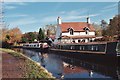
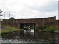
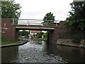
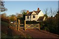
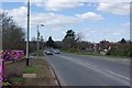
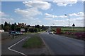
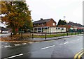
100 photos from this area
Area Information
Key information about the WV5 8EB including its size, population, and administrative classification.
- Area Type
- Postcode
- Area Size
- 1.1 hectares
- Population
- 1518
- Population Density
- 2302 people/km²
House Prices in WV5 8EB
8
Properties
£333,667
Average Sold Price
£236,000
Lowest Price
£405,000
Highest Price
Showing 8 properties
| Address | Type | Beds | Baths | Last Sale Price | Last Sale Date | |
|---|---|---|---|---|---|---|
| 95 Planks Lane, Wombourne, WV5 8EB | Bungalow | - | - | £405,000 | Feb 2021 | |
| 105 Planks Lane, Wombourne, WV5 8EB | Bungalow | 2 | 1 | £236,000 | Aug 2015 | |
| 99 Planks Lane, Wombourne, WV5 8EB | Detached | - | - | £360,000 | May 2007 | |
| 107 Planks Lane, Wombourne, WV5 8EB | Detached | - | - | - | - | |
| 103 Planks Lane, Wombourne, WV5 8EB | Detached | - | - | - | - | |
| 97 Planks Lane, Wombourne, WV5 8EB | Detached | - | - | - | - | |
| Cottage, Steatham Printers Ltd, Planks Lane, Wombourne, WV5 8EB | general_industrial | - | - | - | - | |
| Play Tropolis Centres Limited, 5A, Wombrook Business Park, Planks Lane, Wombourne, WV5 8EB | Industrial | - | - | - | - |
Energy Efficiency in WV5 8EB
Amenities
Schools
| Rank | School | Type | Entry gender | Ages |
|---|
Explore more schools in this area
Go to Schools tabDemographics
Household Size
Two person
most common
Accommodation Type
Houses
most common
Tenure
67
majority
Ethnic Group
White
most common
Religion
N/A
most common
Household Composition
N/A
most common
Age
47
median
Adults (30-64 years)
most common
Household Deprivation
N/A
with no deprivation
NS-SEC
34
in Lower managerial occupations
Explore more demographic insights in this area
Go to Demographics tabPlanning
Planning Constraints
- Flood RiskPremium
- Ramsar Wetland SitesPremium
- Area of Outstanding Natural BeautyPremium
- Protected Nature ReservePremium
- Protected WoodlandPremium