Area Overview for WV5 0JP
Photos of WV5 0JP
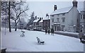


100 photos from this area
Area Information
Key information about the WV5 0JP including its size, population, and administrative classification.
- Area Type
- Postcode
- Area Size
- 10.8 hectares
- Population
- 1367
- Population Density
- 2146 people/km²
House Prices in WV5 0JP
25
Properties
£381,621
Average Sold Price
£160,000
Lowest Price
£840,000
Highest Price
Showing 25 properties
| Address | Type | Beds | Baths | Last Sale Price | Last Sale Date | |
|---|---|---|---|---|---|---|
| 27 Sytch Lane, Wombourne, WV5 0JP | house | - | - | £570,000 | Oct 2022 | |
| 70 Sytch Lane, Wombourne, WV5 0JP | house | - | - | £840,000 | Jan 2021 | |
| 29 Sytch Lane, Wombourne, WV5 0JP | house | - | - | £362,000 | Jun 2020 | |
| 27A Sytch Lane, Wombourne, WV5 0JP | house | 4 | - | £370,000 | Oct 2019 | |
| 19 Sytch Lane, Wombourne, WV5 0JP | Semi-detached | 3 | 1 | £265,000 | Oct 2019 | |
| 39 Sytch Lane, Wombourne, WV5 0JP | house | 4 | 2 | £370,000 | Nov 2015 | |
| 68 Sytch Lane, Wombourne, WV5 0JP | house | - | - | £467,500 | Aug 2015 | |
| 29A Sytch Lane, Wombourne, WV5 0JP | Detached | 3 | 2 | £249,950 | Jun 2013 | |
| 23 Sytch Lane, Wombourne, WV5 0JP | Bungalow | 2 | - | £160,000 | Nov 2012 | |
| 17 Sytch Lane, Wombourne, WV5 0JP | Bungalow | 2 | - | £180,000 | Apr 2012 |
Page 1 of 3
Energy Efficiency in WV5 0JP
Amenities
Schools
| Rank | School | Type | Entry gender | Ages |
|---|
Explore more schools in this area
Go to Schools tabDemographics
Household Size
Family (3-5 people)
most common
Accommodation Type
Houses
most common
Tenure
84
majority
Ethnic Group
White
most common
Religion
N/A
most common
Household Composition
N/A
most common
Age
47
median
Adults (30-64 years)
most common
Household Deprivation
N/A
with no deprivation
NS-SEC
40
in Lower managerial occupations
Explore more demographic insights in this area
Go to Demographics tabPlanning
Planning Constraints
- Flood RiskPremium
- Ramsar Wetland SitesPremium
- Area of Outstanding Natural BeautyPremium
- Protected Nature ReservePremium
- Protected WoodlandPremium