Area Overview for WV4 6GB
Photos of WV4 6GB
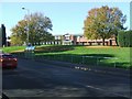
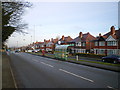

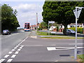
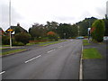
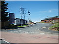
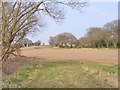
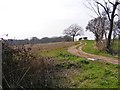
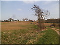

100 photos from this area
Area Information
Key information about the WV4 6GB including its size, population, and administrative classification.
- Area Type
- Postcode
- Area Size
- 20.2 hectares
- Population
- 1389
- Population Density
- 3192 people/km²
House Prices in WV4 6GB
55
Properties
£226,489
Average Sold Price
£65,000
Lowest Price
£423,000
Highest Price
Showing 55 properties
| Address | Type | Beds | Baths | Last Sale Price | Last Sale Date | |
|---|---|---|---|---|---|---|
| 73 Charles Hayward Drive, Wolverhampton, WV4 6GB | Flat | 2 | 1 | £65,000 | Sep 2025 | |
| 92 Charles Hayward Drive, Wolverhampton, WV4 6GB | Semi-detached | 3 | 2 | £260,000 | Jun 2025 | |
| 79 Charles Hayward Drive, Wolverhampton, WV4 6GB | Flat | - | - | £140,000 | Oct 2024 | |
| 75 Charles Hayward Drive, Wolverhampton, WV4 6GB | Flat | - | - | £143,000 | Mar 2024 | |
| 97 Charles Hayward Drive, Wolverhampton, WV4 6GB | Flat | 2 | 1 | £148,000 | Oct 2023 | |
| 129 Charles Hayward Drive, Wolverhampton, WV4 6GB | house | - | - | £423,000 | Oct 2022 | |
| 95 Charles Hayward Drive, Wolverhampton, WV4 6GB | Flat | 2 | 1 | £143,000 | Sep 2022 | |
| 84 Charles Hayward Drive, Wolverhampton, WV4 6GB | house | - | - | £195,000 | May 2022 | |
| 137 Charles Hayward Drive, Wolverhampton, WV4 6GB | Detached | 4 | 2 | £390,000 | Sep 2019 | |
| 94 Charles Hayward Drive, Wolverhampton, WV4 6GB | Terraced | 3 | 2 | £160,000 | May 2019 |
Page 1 of 6
Energy Efficiency in WV4 6GB
Amenities
Schools
| Rank | School | Type | Entry gender | Ages |
|---|
Explore more schools in this area
Go to Schools tabDemographics
Household Size
Two person
most common
Accommodation Type
Houses
most common
Tenure
85
majority
Ethnic Group
White
most common
Religion
N/A
most common
Household Composition
N/A
most common
Age
47
median
Adults (30-64 years)
most common
Household Deprivation
N/A
with no deprivation
NS-SEC
36
in Lower managerial occupations
Explore more demographic insights in this area
Go to Demographics tabPlanning
Planning Constraints
- Flood RiskPremium
- Ramsar Wetland SitesPremium
- Area of Outstanding Natural BeautyPremium
- Protected Nature ReservePremium
- Protected WoodlandPremium