Area Overview for WV3 0AB
Photos of WV3 0AB

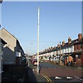
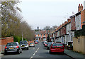
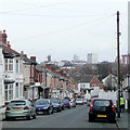
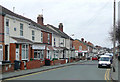
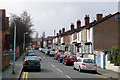


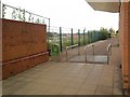
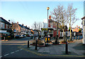
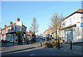

100 photos from this area
Area Information
Key information about the WV3 0AB including its size, population, and administrative classification.
- Area Type
- Postcode
- Area Size
- 2.8 hectares
- Population
- 1615
- Population Density
- 5012 people/km²
House Prices in WV3 0AB
71
Properties
£255,579
Average Sold Price
£1,000
Lowest Price
£590,000
Highest Price
Showing 71 properties
| Address | Type | Beds | Baths | Last Sale Price | Last Sale Date | |
|---|---|---|---|---|---|---|
| 10 Copthorne Road, Wolverhampton, WV3 0AB | house | 3 | 1 | £351,000 | Feb 2024 | |
| 16 Copthorne Road, Wolverhampton, WV3 0AB | Detached | 3 | 1 | £325,000 | Feb 2024 | |
| 30 Copthorne Road, Wolverhampton, WV3 0AB | Detached | 5 | 2 | £380,000 | Nov 2023 | |
| 20 Copthorne Road, Wolverhampton, WV3 0AB | house | - | - | £400,000 | Oct 2023 | |
| 5 Copthorne Road, Wolverhampton, WV3 0AB | Semi-detached | 6 | 4 | £420,000 | Dec 2022 | |
| 8 Copthorne Road, Wolverhampton, WV3 0AB | Detached | 5 | 3 | £330,000 | Sep 2021 | |
| 17 Copthorne Road, Wolverhampton, WV3 0AB | Detached | 4 | - | £590,000 | Jun 2021 | |
| 33 Copthorne Road, Wolverhampton, WV3 0AB | house | - | - | £382,000 | Apr 2021 | |
| 14 Copthorne Road, Wolverhampton, WV3 0AB | house | - | - | £272,500 | Nov 2020 | |
| 19 Copthorne Road, Wolverhampton, WV3 0AB | house | - | - | £550,000 | Feb 2020 |
Page 1 of 8
Energy Efficiency in WV3 0AB
Amenities
Schools
| Rank | School | Type | Entry gender | Ages |
|---|
Explore more schools in this area
Go to Schools tabDemographics
Household Size
One person
most common
Accommodation Type
Houses
most common
Tenure
56
majority
Ethnic Group
White
most common
Religion
N/A
most common
Household Composition
N/A
most common
Age
47
median
Adults (30-64 years)
most common
Household Deprivation
N/A
with no deprivation
NS-SEC
27
in Lower managerial occupations
Explore more demographic insights in this area
Go to Demographics tabPlanning
Planning Constraints
- Flood RiskPremium
- Ramsar Wetland SitesPremium
- Area of Outstanding Natural BeautyPremium
- Protected Nature ReservePremium
- Protected WoodlandPremium