Area Overview for WV2 4QT
Photos of WV2 4QT

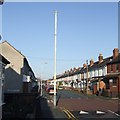
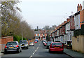
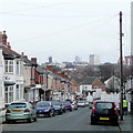
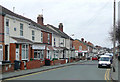
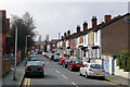


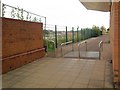
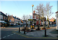
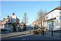

100 photos from this area
Area Information
Key information about the WV2 4QT including its size, population, and administrative classification.
- Area Type
- Postcode
- Area Size
- 3.1 hectares
- Population
- 1359
- Population Density
- 6714 people/km²
House Prices in WV2 4QT
13
Properties
-
Average Sold Price
-
Lowest Price
-
Highest Price
Showing 13 properties
| Address | Type | Beds | Baths | Last Sale Price | Last Sale Date | |
|---|---|---|---|---|---|---|
| J And R, Unit M1c, Moorfield House, Moorfield Road, Wolverhampton, WV2 4QT | Office | - | - | - | - | |
| S G K Fashion, Unit 2, Blakenhall Industrial Estate, Moorfield Road, Wolverhampton, WV2 4QT | storage_distribution | - | - | - | - | |
| Hilda Haywood Swimming Pool, Goldthorn Road, Wolverhampton, WV2 4QT | Leisure | - | - | - | - | |
| Euro Auto Solutions Ltd, Imperial House, Moorfield Road, Wolverhampton, WV2 4QT | Office | - | - | - | - | |
| Unit 7, Blakenhall Industrial Estate, Moorfield Road, Wolverhampton, WV2 4QT | Industrial | - | - | - | - | |
| B E R Ltd, Unit 3A, Blakenhall Industrial Estate, Moorfield Road, Wolverhampton, WV2 4QT | Industrial | - | - | - | - | |
| Unit 6, Blakenhall Industrial Estate, Moorfield Road, Wolverhampton, WV2 4QT | Industrial | - | - | - | - | |
| G B Safe Co, Unit 4, Blakenhall Industrial Estate, Moorfield Road, Wolverhampton, WV2 4QT | storage_distribution | - | - | - | - | |
| Office 2 First Floor, Imperial House, Moorfield Road, Wolverhampton, WV2 4QT | storage_distribution | - | - | - | - | |
| Ground Floor Office, Imperial House, Moorfield Road, Wolverhampton, WV2 4QT | Office | - | - | - | - |
Page 1 of 2
Energy Efficiency in WV2 4QT
Amenities
Schools
| Rank | School | Type | Entry gender | Ages |
|---|
Explore more schools in this area
Go to Schools tabDemographics
Household Size
Family (3-5 people)
most common
Accommodation Type
Houses
most common
Tenure
50
majority
Ethnic Group
asian_total
most common
Religion
N/A
most common
Household Composition
N/A
most common
Age
47
median
Adults (30-64 years)
most common
Household Deprivation
N/A
with no deprivation
NS-SEC
13
in Lower managerial occupations
Explore more demographic insights in this area
Go to Demographics tabPlanning
Planning Constraints
- Flood RiskPremium
- Ramsar Wetland SitesPremium
- Area of Outstanding Natural BeautyPremium
- Protected Nature ReservePremium
- Protected WoodlandPremium