Area Overview for WV2 4NX
Photos of WV2 4NX
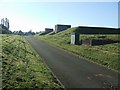
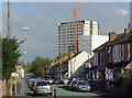
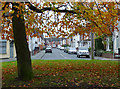
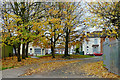
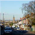
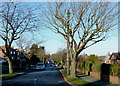
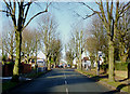
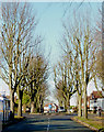
100 photos from this area
Area Information
Key information about the WV2 4NX including its size, population, and administrative classification.
- Area Type
- Postcode
- Area Size
- 1.3 hectares
- Population
- 1827
- Population Density
- 5530 people/km²
House Prices in WV2 4NX
34
Properties
£99,100
Average Sold Price
£16,500
Lowest Price
£350,000
Highest Price
Showing 34 properties
| Address | Type | Beds | Baths | Last Sale Price | Last Sale Date | |
|---|---|---|---|---|---|---|
| 68 Upper Villiers Street, Wolverhampton, WV2 4NX | Detached | 4 | 2 | £350,000 | Jul 2023 | |
| 72 Upper Villiers Street, Wolverhampton, WV2 4NX | house | - | - | £125,000 | Jan 2022 | |
| 75 Upper Villiers Street, Wolverhampton, WV2 4NX | house | - | - | £183,000 | Aug 2021 | |
| 59 Upper Villiers Street, Wolverhampton, WV2 4NX | Flat | - | - | £100,500 | Feb 2019 | |
| 65 Upper Villiers Street, Wolverhampton, WV2 4NX | Terraced | 3 | - | £150,000 | Jun 2017 | |
| 87A Upper Villiers Street, Wolverhampton, WV2 4NX | Maisonette | - | - | £152,000 | Jul 2015 | |
| 66 Upper Villiers Street, Wolverhampton, WV2 4NX | Detached | 3 | 1 | £102,500 | Jun 2015 | |
| 64 Upper Villiers Street, Wolverhampton, WV2 4NX | Terraced | 2 | - | £111,000 | Jan 2013 | |
| 86A Upper Villiers Street, Wolverhampton, WV2 4NX | Maisonette | - | - | £180,000 | Sep 2011 | |
| 62 Upper Villiers Street, Wolverhampton, WV2 4NX | Terraced | - | - | £128,000 | Dec 2007 |
Page 1 of 4
Energy Efficiency in WV2 4NX
Amenities
Schools
| Rank | School | Type | Entry gender | Ages |
|---|
Explore more schools in this area
Go to Schools tabDemographics
Household Size
Family (3-5 people)
most common
Accommodation Type
Houses
most common
Tenure
64
majority
Ethnic Group
asian_total
most common
Religion
N/A
most common
Household Composition
N/A
most common
Age
47
median
Adults (30-64 years)
most common
Household Deprivation
N/A
with no deprivation
NS-SEC
18
in Lower managerial occupations
Explore more demographic insights in this area
Go to Demographics tabPlanning
Planning Constraints
- Flood RiskPremium
- Ramsar Wetland SitesPremium
- Area of Outstanding Natural BeautyPremium
- Protected Nature ReservePremium
- Protected WoodlandPremium