Area Overview for WV2 1DT
Photos of WV2 1DT


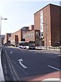
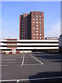
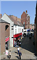
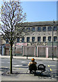
100 photos from this area
Area Information
Key information about the WV2 1DT including its size, population, and administrative classification.
- Area Type
- Postcode
- Area Size
- 4622 m²
- Population
- 1939
- Population Density
- 3795 people/km²
House Prices in WV2 1DT
34
Properties
£114,821
Average Sold Price
£30,500
Lowest Price
£164,995
Highest Price
Showing 34 properties
| Address | Type | Beds | Baths | Last Sale Price | Last Sale Date | |
|---|---|---|---|---|---|---|
| 34 Vicarage Road, Parkfield, Wolverhampton, WV2 1DT | Terraced | 2 | 1 | £106,000 | Feb 2025 | |
| All Saints Vicarage, 2A Vicarage Road, Parkfield, Wolverhampton, WV2 1DT | Terraced | 3 | - | £162,000 | Jun 2022 | |
| 2A Vicarage Road, Parkfield, Wolverhampton, WV2 1DT | house | - | - | £162,000 | Jun 2022 | |
| 24 Vicarage Road, Parkfield, Wolverhampton, WV2 1DT | house | - | - | £160,000 | Nov 2020 | |
| 28 Vicarage Road, Parkfield, Wolverhampton, WV2 1DT | Terraced | 4 | - | £117,000 | Jun 2016 | |
| 30 Vicarage Road, Parkfield, Wolverhampton, WV2 1DT | house | - | - | £75,000 | Jan 2016 | |
| 22 Vicarage Road, Parkfield, Wolverhampton, WV2 1DT | house | 3 | 1 | £119,995 | Sep 2015 | |
| 20 Vicarage Road, Parkfield, Wolverhampton, WV2 1DT | house | - | - | £160,000 | Aug 2015 | |
| 26 Vicarage Road, Parkfield, Wolverhampton, WV2 1DT | house | - | - | £164,995 | Mar 2015 | |
| 46 Vicarage Road, Parkfield, Wolverhampton, WV2 1DT | house | - | - | £30,500 | Oct 2011 |
Page 1 of 4
Energy Efficiency in WV2 1DT
Amenities
Schools
| Rank | School | Type | Entry gender | Ages |
|---|
Explore more schools in this area
Go to Schools tabDemographics
Household Size
Family (3-5 people)
most common
Accommodation Type
Houses
most common
Tenure
32
majority
Ethnic Group
asian_total
most common
Religion
N/A
most common
Household Composition
N/A
most common
Age
47
median
Adults (30-64 years)
most common
Household Deprivation
N/A
with no deprivation
NS-SEC
13
in Lower managerial occupations
Explore more demographic insights in this area
Go to Demographics tabPlanning
Planning Constraints
- Flood RiskPremium
- Ramsar Wetland SitesPremium
- Area of Outstanding Natural BeautyPremium
- Protected Nature ReservePremium
- Protected WoodlandPremium