Area Overview for WV15 6PT
Photos of WV15 6PT
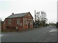
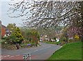

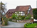

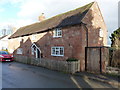
38 photos from this area
Area Information
Key information about the WV15 6PT including its size, population, and administrative classification.
- Area Type
- Postcode
- Area Size
- 8255 m²
- Population
- 1253
- Population Density
- 1370 people/km²
House Prices in WV15 6PT
10
Properties
£354,400
Average Sold Price
£250,000
Lowest Price
£475,000
Highest Price
Showing 10 properties
| Address | Type | Beds | Baths | Last Sale Price | Last Sale Date | |
|---|---|---|---|---|---|---|
| Jeeves, Daddlebrook Road, Alveley, WV15 6PT | Detached | 4 | 4 | £475,000 | Jan 2022 | |
| At Last, Daddlebrook Road, Alveley, WV15 6PT | Bungalow | - | - | £295,000 | Sep 2021 | |
| Brookfield, Daddlebrook Road, Alveley, WV15 6PT | house | 3 | 1 | £455,000 | Jun 2021 | |
| 90 Daddlebrook Road, Alveley, WV15 6PT | house | - | - | £297,000 | Jan 2020 | |
| 21 Daddlebrook Road, Alveley, WV15 6PT | Detached | - | - | £250,000 | Jul 2006 | |
| 19 Daddlebrook Road, Alveley, WV15 6PT | Detached | - | - | - | - | |
| 89 Daddlebrook Road, Alveley, WV15 6PT | Semi-detached | - | - | - | - | |
| 91 Daddlebrook Road, Alveley, WV15 6PT | Semi-detached | - | - | - | - | |
| South View, Daddlebrook Road, Alveley, WV15 6PT | house | - | - | - | - | |
| Rehoboth, Daddlebrook Road, Alveley, WV15 6PT | Bungalow | - | - | - | - |
Energy Efficiency in WV15 6PT
Amenities
Schools
| Rank | School | Type | Entry gender | Ages |
|---|
Explore more schools in this area
Go to Schools tabDemographics
Household Size
Two person
most common
Accommodation Type
Houses
most common
Tenure
84
majority
Ethnic Group
White
most common
Religion
N/A
most common
Household Composition
N/A
most common
Age
47
median
Adults (30-64 years)
most common
Household Deprivation
N/A
with no deprivation
NS-SEC
38
in Lower managerial occupations
Explore more demographic insights in this area
Go to Demographics tabPlanning
Planning Constraints
- Flood RiskPremium
- Ramsar Wetland SitesPremium
- Area of Outstanding Natural BeautyPremium
- Protected Nature ReservePremium
- Protected WoodlandPremium