Area Overview for WV14 9PA
Photos of WV14 9PA
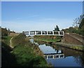
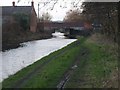
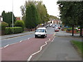
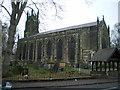


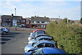
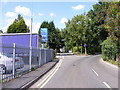
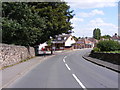
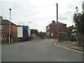
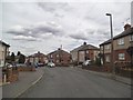
100 photos from this area
Area Information
Key information about the WV14 9PA including its size, population, and administrative classification.
- Area Type
- Postcode
- Area Size
- 5.0 hectares
- Population
- 1481
- Population Density
- 2870 people/km²
House Prices in WV14 9PA
81
Properties
£138,133
Average Sold Price
£7,395
Lowest Price
£243,000
Highest Price
Showing 81 properties
| Address | Type | Beds | Baths | Last Sale Price | Last Sale Date | |
|---|---|---|---|---|---|---|
| 45 Bridgewater Drive, Coseley, WV14 9PA | Semi-detached | 3 | 1 | £205,000 | Dec 2024 | |
| 48 Bridgewater Drive, Coseley, WV14 9PA | Semi-detached | 2 | 1 | £198,500 | Oct 2023 | |
| 41 Bridgewater Drive, Coseley, WV14 9PA | Detached | 3 | 1 | £230,000 | Feb 2023 | |
| 5 Bridgewater Drive, Coseley, WV14 9PA | house | - | - | £212,500 | Nov 2022 | |
| 26 Bridgewater Drive, Coseley, WV14 9PA | Semi-detached | 2 | 1 | £180,000 | Oct 2021 | |
| 61 Bridgewater Drive, Coseley, WV14 9PA | house | - | - | £243,000 | Jun 2021 | |
| 51A Bridgewater Drive, Coseley, WV14 9PA | Detached | 3 | 1 | £236,000 | May 2021 | |
| 7 Bridgewater Drive, Coseley, WV14 9PA | house | - | - | £160,000 | Mar 2021 | |
| 57 Bridgewater Drive, Coseley, WV14 9PA | house | - | - | £190,000 | Mar 2021 | |
| 30 Bridgewater Drive, Coseley, WV14 9PA | Semi-detached | 2 | 1 | £137,000 | Mar 2020 |
Page 1 of 9
Energy Efficiency in WV14 9PA
Amenities
Schools
| Rank | School | Type | Entry gender | Ages |
|---|
Explore more schools in this area
Go to Schools tabDemographics
Household Size
Two person
most common
Accommodation Type
Houses
most common
Tenure
86
majority
Ethnic Group
White
most common
Religion
N/A
most common
Household Composition
N/A
most common
Age
47
median
Adults (30-64 years)
most common
Household Deprivation
N/A
with no deprivation
NS-SEC
25
in Lower managerial occupations
Explore more demographic insights in this area
Go to Demographics tabPlanning
Planning Constraints
- Flood RiskPremium
- Ramsar Wetland SitesPremium
- Area of Outstanding Natural BeautyPremium
- Protected Nature ReservePremium
- Protected WoodlandPremium