Area Overview for WV14 8AL
Photos of WV14 8AL


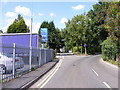
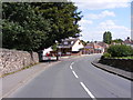
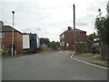
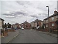
100 photos from this area
Area Information
Key information about the WV14 8AL including its size, population, and administrative classification.
- Area Type
- Postcode
- Area Size
- 1.1 hectares
- Population
- 1530
- Population Density
- 5584 people/km²
House Prices in WV14 8AL
24
Properties
£192,644
Average Sold Price
£77,450
Lowest Price
£325,000
Highest Price
Showing 24 properties
| Address | Type | Beds | Baths | Last Sale Price | Last Sale Date | |
|---|---|---|---|---|---|---|
| 8 Seagull Bay Drive, Coseley, WV14 8AL | Detached | 3 | 1 | £325,000 | Mar 2025 | |
| 11 Seagull Bay Drive, Coseley, WV14 8AL | house | - | - | £290,000 | Jul 2024 | |
| 33 Seagull Bay Drive, Coseley, WV14 8AL | Detached | 3 | 2 | £230,000 | Dec 2021 | |
| 37 Seagull Bay Drive, Coseley, WV14 8AL | Detached | 4 | 2 | £293,000 | May 2021 | |
| 10 Seagull Bay Drive, Coseley, WV14 8AL | house | - | - | £255,000 | Mar 2021 | |
| 29 Seagull Bay Drive, Coseley, WV14 8AL | house | - | - | £300,000 | Mar 2021 | |
| 7 Seagull Bay Drive, Coseley, WV14 8AL | Detached | 4 | 2 | £262,000 | Jan 2021 | |
| 3 Seagull Bay Drive, Coseley, WV14 8AL | Detached | 3 | 1 | £240,000 | Sep 2020 | |
| 39 Seagull Bay Drive, Coseley, WV14 8AL | Detached | 4 | 2 | £265,000 | Dec 2019 | |
| 35 Seagull Bay Drive, Coseley, WV14 8AL | Detached | 3 | 1 | £245,000 | Feb 2019 |
Page 1 of 3
Energy Efficiency in WV14 8AL
Amenities
Schools
| Rank | School | Type | Entry gender | Ages |
|---|
Explore more schools in this area
Go to Schools tabDemographics
Household Size
Family (3-5 people)
most common
Accommodation Type
Houses
most common
Tenure
64
majority
Ethnic Group
White
most common
Religion
N/A
most common
Household Composition
N/A
most common
Age
47
median
Adults (30-64 years)
most common
Household Deprivation
N/A
with no deprivation
NS-SEC
22
in Lower managerial occupations
Explore more demographic insights in this area
Go to Demographics tabPlanning
Planning Constraints
- Flood RiskPremium
- Ramsar Wetland SitesPremium
- Area of Outstanding Natural BeautyPremium
- Protected Nature ReservePremium
- Protected WoodlandPremium