Area Overview for WV14 6NS
Photos of WV14 6NS
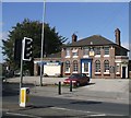
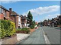
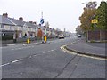
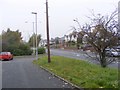
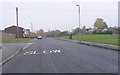
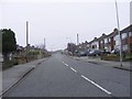
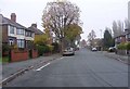
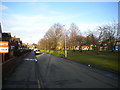
100 photos from this area
Area Information
Key information about the WV14 6NS including its size, population, and administrative classification.
- Area Type
- Postcode
- Area Size
- 1.4 hectares
- Population
- 1658
- Population Density
- 7492 people/km²
House Prices in WV14 6NS
51
Properties
£111,439
Average Sold Price
£32,950
Lowest Price
£180,500
Highest Price
Showing 51 properties
| Address | Type | Beds | Baths | Last Sale Price | Last Sale Date | |
|---|---|---|---|---|---|---|
| 35 Russell Road, Wolverhampton, WV14 6NS | house | - | - | £122,000 | Oct 2023 | |
| 6 Russell Road, Wolverhampton, WV14 6NS | house | 2 | 1 | £180,500 | Feb 2023 | |
| 21 Russell Road, Wolverhampton, WV14 6NS | house | - | - | £135,000 | May 2022 | |
| 2B Russell Road, Wolverhampton, WV14 6NS | house | - | - | £160,000 | Apr 2022 | |
| 2 Russell Road, Wolverhampton, WV14 6NS | house | - | - | £136,000 | Aug 2021 | |
| 15 Russell Road, Wolverhampton, WV14 6NS | Terraced | 4 | 1 | £128,000 | Feb 2019 | |
| 57 Russell Road, Wolverhampton, WV14 6NS | Semi-detached | 2 | 1 | £115,000 | Dec 2018 | |
| 13 Russell Road, Wolverhampton, WV14 6NS | Terraced | 3 | 1 | £88,720 | Jul 2015 | |
| 29 Russell Road, Wolverhampton, WV14 6NS | house | - | - | £63,100 | Mar 2009 | |
| 2A Russell Road, Wolverhampton, WV14 6NS | Semi-detached | 4 | 1 | £109,000 | Mar 2006 |
Page 1 of 6
Energy Efficiency in WV14 6NS
Amenities
Schools
| Rank | School | Type | Entry gender | Ages |
|---|
Explore more schools in this area
Go to Schools tabDemographics
Household Size
Family (3-5 people)
most common
Accommodation Type
Houses
most common
Tenure
42
majority
Ethnic Group
White
most common
Religion
N/A
most common
Household Composition
N/A
most common
Age
47
median
Adults (30-64 years)
most common
Household Deprivation
N/A
with no deprivation
NS-SEC
13
in Lower managerial occupations
Explore more demographic insights in this area
Go to Demographics tabPlanning
Planning Constraints
- Flood RiskPremium
- Ramsar Wetland SitesPremium
- Area of Outstanding Natural BeautyPremium
- Protected Nature ReservePremium
- Protected WoodlandPremium