Area Overview for WV14 0UU
Photos of WV14 0UU

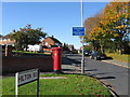
100 photos from this area
Area Information
Key information about the WV14 0UU including its size, population, and administrative classification.
- Area Type
- Postcode
- Area Size
- 1.2 hectares
- Population
- 2033
- Population Density
- 1549 people/km²
House Prices in WV14 0UU
13
Properties
£161,127
Average Sold Price
£78,250
Lowest Price
£331,000
Highest Price
Showing 13 properties
| Address | Type | Beds | Baths | Last Sale Price | Last Sale Date | |
|---|---|---|---|---|---|---|
| 6 Acton Grove, Wolverhampton, WV14 0UU | house | - | - | £331,000 | Nov 2021 | |
| 8 Acton Grove, Wolverhampton, WV14 0UU | Detached | 4 | 3 | £225,000 | Apr 2019 | |
| 2 Acton Grove, Wolverhampton, WV14 0UU | house | - | - | £233,000 | Jan 2018 | |
| 12 Acton Grove, Wolverhampton, WV14 0UU | house | - | - | £184,995 | Jun 2014 | |
| 5 Acton Grove, Wolverhampton, WV14 0UU | house | - | - | £191,000 | Feb 2012 | |
| 7 Acton Grove, Wolverhampton, WV14 0UU | house | - | - | £195,000 | Oct 2011 | |
| 4 Acton Grove, Wolverhampton, WV14 0UU | Detached | - | - | £148,950 | Apr 2003 | |
| 3 Acton Grove, Wolverhampton, WV14 0UU | Detached | - | - | £138,000 | Feb 2003 | |
| 9 Acton Grove, Wolverhampton, WV14 0UU | house | - | - | £78,250 | Jul 2001 | |
| 11 Acton Grove, Wolverhampton, WV14 0UU | Detached | - | - | £89,950 | Dec 1997 |
Page 1 of 2
Energy Efficiency in WV14 0UU
Amenities
Schools
| Rank | School | Type | Entry gender | Ages |
|---|
Explore more schools in this area
Go to Schools tabDemographics
Household Size
Family (3-5 people)
most common
Accommodation Type
Houses
most common
Tenure
53
majority
Ethnic Group
White
most common
Religion
N/A
most common
Household Composition
N/A
most common
Age
47
median
Adults (30-64 years)
most common
Household Deprivation
N/A
with no deprivation
NS-SEC
26
in Lower managerial occupations
Explore more demographic insights in this area
Go to Demographics tabPlanning
Planning Constraints
- Flood RiskPremium
- Ramsar Wetland SitesPremium
- Area of Outstanding Natural BeautyPremium
- Protected Nature ReservePremium
- Protected WoodlandPremium