Area Overview for WV14 0SR
Photos of WV14 0SR
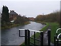
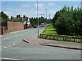
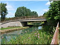
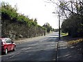
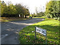
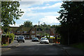
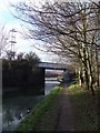
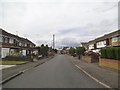
100 photos from this area
Area Information
Key information about the WV14 0SR including its size, population, and administrative classification.
- Area Type
- Postcode
- Area Size
- 2.1 hectares
- Population
- 2033
- Population Density
- 1549 people/km²
House Prices in WV14 0SR
52
Properties
£295,290
Average Sold Price
£224,995
Lowest Price
£380,000
Highest Price
Showing 52 properties
| Address | Type | Beds | Baths | Last Sale Price | Last Sale Date | |
|---|---|---|---|---|---|---|
| 60 Ambergate Road, Wolverhampton, WV14 0SR | house | - | - | £365,000 | May 2025 | |
| 34 Ambergate Road, Wolverhampton, WV14 0SR | house | - | - | £380,000 | Mar 2025 | |
| 86 Ambergate Road, Wolverhampton, WV14 0SR | house | - | - | £304,995 | Apr 2022 | |
| 82 Ambergate Road, Wolverhampton, WV14 0SR | Detached | 4 | 2 | £332,995 | Mar 2022 | |
| 30 Ambergate Road, Wolverhampton, WV14 0SR | house | - | - | £339,995 | Mar 2022 | |
| 90 Ambergate Road, Wolverhampton, WV14 0SR | house | - | - | £245,995 | Mar 2022 | |
| 84 Ambergate Road, Wolverhampton, WV14 0SR | house | - | - | £335,995 | Mar 2022 | |
| 76 Ambergate Road, Wolverhampton, WV14 0SR | house | - | - | £258,995 | Mar 2022 | |
| 78 Ambergate Road, Wolverhampton, WV14 0SR | Semi-detached | 3 | 2 | £255,600 | Mar 2022 | |
| 80 Ambergate Road, Wolverhampton, WV14 0SR | house | - | - | £299,995 | Mar 2022 |
Page 1 of 6
Energy Efficiency in WV14 0SR
Amenities
Schools
| Rank | School | Type | Entry gender | Ages |
|---|
Explore more schools in this area
Go to Schools tabDemographics
Household Size
Family (3-5 people)
most common
Accommodation Type
Houses
most common
Tenure
53
majority
Ethnic Group
White
most common
Religion
N/A
most common
Household Composition
N/A
most common
Age
47
median
Adults (30-64 years)
most common
Household Deprivation
N/A
with no deprivation
NS-SEC
26
in Lower managerial occupations
Explore more demographic insights in this area
Go to Demographics tabPlanning
Planning Constraints
- Flood RiskPremium
- Ramsar Wetland SitesPremium
- Area of Outstanding Natural BeautyPremium
- Protected Nature ReservePremium
- Protected WoodlandPremium