Area Overview for WV13 2SA
Photos of WV13 2SA
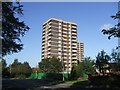
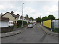
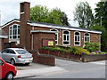
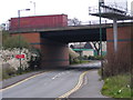
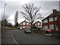
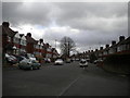


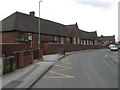
38 photos from this area
Area Information
Key information about the WV13 2SA including its size, population, and administrative classification.
- Area Type
- Postcode
- Area Size
- 5.5 hectares
- Population
- 1750
- Population Density
- 5388 people/km²
House Prices in WV13 2SA
33
Properties
£166,033
Average Sold Price
£57,950
Lowest Price
£425,000
Highest Price
Showing 33 properties
| Address | Type | Beds | Baths | Last Sale Price | Last Sale Date | |
|---|---|---|---|---|---|---|
| 22 Riverbank Road, Willenhall, WV13 2SA | Semi-detached | 3 | 2 | £230,000 | Feb 2025 | |
| 15 Riverbank Road, Willenhall, WV13 2SA | house | 4 | 2 | £407,500 | Aug 2023 | |
| 11 Riverbank Road, Willenhall, WV13 2SA | house | - | - | £425,000 | Dec 2022 | |
| 52 Riverbank Road, Willenhall, WV13 2SA | Semi-detached | 3 | 1 | £173,000 | Jul 2018 | |
| 33 Riverbank Road, Willenhall, WV13 2SA | Semi-detached | 3 | 2 | £164,500 | Jun 2018 | |
| 18 Riverbank Road, Willenhall, WV13 2SA | Semi-detached | 3 | 1 | £170,000 | Jun 2018 | |
| 17 Riverbank Road, Willenhall, WV13 2SA | Detached | 6 | 2 | £320,000 | Nov 2015 | |
| 20 Riverbank Road, Willenhall, WV13 2SA | Semi-detached | 4 | - | £190,000 | Aug 2015 | |
| 12 Riverbank Road, Willenhall, WV13 2SA | Semi-detached | 3 | - | £135,000 | Mar 2015 | |
| 25 Riverbank Road, Willenhall, WV13 2SA | Detached | 4 | 2 | £217,500 | Mar 2015 |
Page 1 of 4
Energy Efficiency in WV13 2SA
Amenities
Schools
| Rank | School | Type | Entry gender | Ages |
|---|
Explore more schools in this area
Go to Schools tabDemographics
Household Size
Family (3-5 people)
most common
Accommodation Type
Houses
most common
Tenure
68
majority
Ethnic Group
White
most common
Religion
N/A
most common
Household Composition
N/A
most common
Age
47
median
Adults (30-64 years)
most common
Household Deprivation
N/A
with no deprivation
NS-SEC
22
in Lower managerial occupations
Explore more demographic insights in this area
Go to Demographics tabPlanning
Planning Constraints
- Flood RiskPremium
- Ramsar Wetland SitesPremium
- Area of Outstanding Natural BeautyPremium
- Protected Nature ReservePremium
- Protected WoodlandPremium