Area Overview for WV12 5EQ
Photos of WV12 5EQ
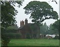

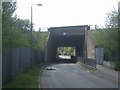
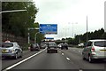


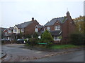
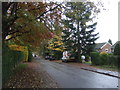
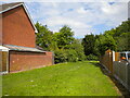
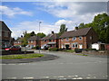
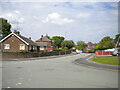
25 photos from this area
Area Information
Key information about the WV12 5EQ including its size, population, and administrative classification.
- Area Type
- Postcode
- Area Size
- 9113 m²
- Population
- 1525
- Population Density
- 6162 people/km²
House Prices in WV12 5EQ
20
Properties
£115,285
Average Sold Price
£49,250
Lowest Price
£197,000
Highest Price
Showing 20 properties
| Address | Type | Beds | Baths | Last Sale Price | Last Sale Date | |
|---|---|---|---|---|---|---|
| 18 Radstock Road, Willenhall, WV12 5EQ | Semi-detached | 2 | 1 | £197,000 | Aug 2023 | |
| 22 Radstock Road, Willenhall, WV12 5EQ | Semi-detached | 3 | - | £170,000 | Sep 2018 | |
| 7 Radstock Road, Willenhall, WV12 5EQ | Semi-detached | 2 | 1 | £133,000 | Feb 2017 | |
| 24 Radstock Road, Willenhall, WV12 5EQ | house | - | - | £145,000 | Mar 2013 | |
| 5 Radstock Road, Willenhall, WV12 5EQ | house | - | - | £78,000 | Sep 2010 | |
| 6 Radstock Road, Willenhall, WV12 5EQ | house | - | - | £144,000 | Dec 2009 | |
| 4 Radstock Road, Willenhall, WV12 5EQ | house | 3 | - | £150,000 | Dec 2007 | |
| 14 Radstock Road, Willenhall, WV12 5EQ | Semi-detached | - | - | £125,450 | Jul 2005 | |
| 26 Radstock Road, Willenhall, WV12 5EQ | Semi-detached | - | - | £97,000 | Sep 2002 | |
| 9 Radstock Road, Willenhall, WV12 5EQ | Semi-detached | - | - | £74,500 | Jun 2002 |
Page 1 of 2
Energy Efficiency in WV12 5EQ
Amenities
Schools
| Rank | School | Type | Entry gender | Ages |
|---|
Explore more schools in this area
Go to Schools tabDemographics
Household Size
Two person
most common
Accommodation Type
Houses
most common
Tenure
74
majority
Ethnic Group
White
most common
Religion
N/A
most common
Household Composition
N/A
most common
Age
47
median
Adults (30-64 years)
most common
Household Deprivation
N/A
with no deprivation
NS-SEC
26
in Lower managerial occupations
Explore more demographic insights in this area
Go to Demographics tabPlanning
Planning Constraints
- Flood RiskPremium
- Ramsar Wetland SitesPremium
- Area of Outstanding Natural BeautyPremium
- Protected Nature ReservePremium
- Protected WoodlandPremium