Area Overview for WV12 4JB
Photos of WV12 4JB
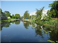
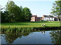
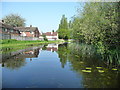
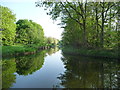
57 photos from this area
Area Information
Key information about the WV12 4JB including its size, population, and administrative classification.
- Area Type
- Postcode
- Area Size
- 1.6 hectares
- Population
- 1570
- Population Density
- 4785 people/km²
House Prices in WV12 4JB
56
Properties
£112,875
Average Sold Price
£67,000
Lowest Price
£170,000
Highest Price
Showing 56 properties
| Address | Type | Beds | Baths | Last Sale Price | Last Sale Date | |
|---|---|---|---|---|---|---|
| 65 Shepherd Drive, Willenhall, WV12 4JB | Semi-detached | 2 | 1 | £170,000 | Mar 2025 | |
| 150 Shepherd Drive, Willenhall, WV12 4JB | Flat | - | - | £100,000 | Mar 2025 | |
| 71 Shepherd Drive, Willenhall, WV12 4JB | Semi-detached | 2 | 1 | £145,000 | Feb 2023 | |
| 120 Shepherd Drive, Willenhall, WV12 4JB | Flat | - | - | £71,000 | Feb 2022 | |
| 69 Shepherd Drive, Willenhall, WV12 4JB | Semi-detached | 2 | 1 | £138,000 | Oct 2020 | |
| 146 Shepherd Drive, Willenhall, WV12 4JB | Flat | - | - | £67,000 | Aug 2020 | |
| 63 Shepherd Drive, Willenhall, WV12 4JB | Semi-detached | 3 | 2 | £110,000 | Jul 2017 | |
| 75 Shepherd Drive, Willenhall, WV12 4JB | house | - | - | £102,000 | Jan 2017 | |
| 128 Shepherd Drive, Willenhall, WV12 4JB | Flat | 1 | 1 | - | - | |
| 118 Shepherd Drive, Willenhall, WV12 4JB | Flat | - | - | - | - |
Page 1 of 6
Energy Efficiency in WV12 4JB
Amenities
Schools
| Rank | School | Type | Entry gender | Ages |
|---|
Explore more schools in this area
Go to Schools tabDemographics
Household Size
Two person
most common
Accommodation Type
Houses
most common
Tenure
52
majority
Ethnic Group
White
most common
Religion
N/A
most common
Household Composition
N/A
most common
Age
47
median
Adults (30-64 years)
most common
Household Deprivation
N/A
with no deprivation
NS-SEC
18
in Lower managerial occupations
Explore more demographic insights in this area
Go to Demographics tabPlanning
Planning Constraints
- Flood RiskPremium
- Ramsar Wetland SitesPremium
- Area of Outstanding Natural BeautyPremium
- Protected Nature ReservePremium
- Protected WoodlandPremium