Area Overview for WV11 3TX
Photos of WV11 3TX
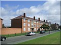
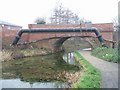
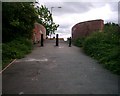
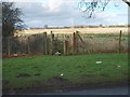
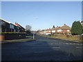
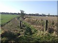
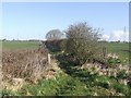
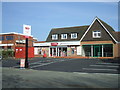
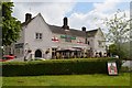
45 photos from this area
Area Information
Key information about the WV11 3TX including its size, population, and administrative classification.
- Area Type
- Postcode
- Area Size
- 1.5 hectares
- Population
- 1637
- Population Density
- 6306 people/km²
House Prices in WV11 3TX
44
Properties
£123,103
Average Sold Price
£59,000
Lowest Price
£237,500
Highest Price
Showing 44 properties
| Address | Type | Beds | Baths | Last Sale Price | Last Sale Date | |
|---|---|---|---|---|---|---|
| 16 Ridge Lane, Wolverhampton, WV11 3TX | Semi-detached | 3 | 1 | £237,500 | Jun 2024 | |
| 35 Ridge Lane, Wolverhampton, WV11 3TX | Semi-detached | 3 | 1 | £235,000 | Nov 2022 | |
| 30 Ridge Lane, Wolverhampton, WV11 3TX | Semi-detached | 3 | 1 | £150,000 | Nov 2021 | |
| 48 Ridge Lane, Wolverhampton, WV11 3TX | Semi-detached | 3 | 1 | £132,000 | Feb 2019 | |
| 34 Ridge Lane, Wolverhampton, WV11 3TX | Semi-detached | 3 | 1 | £142,000 | May 2018 | |
| 38 Ridge Lane, Wolverhampton, WV11 3TX | Semi-detached | 3 | 1 | £143,000 | Aug 2017 | |
| 54 Ridge Lane, Wolverhampton, WV11 3TX | Semi-detached | 3 | - | £98,000 | Feb 2016 | |
| 53 Ridge Lane, Wolverhampton, WV11 3TX | Semi-detached | 3 | 1 | £104,000 | May 2015 | |
| 64 Ridge Lane, Wolverhampton, WV11 3TX | Detached | 3 | - | £151,000 | Oct 2014 | |
| 58 Ridge Lane, Wolverhampton, WV11 3TX | house | - | - | £110,000 | Mar 2014 |
Page 1 of 5
Energy Efficiency in WV11 3TX
Amenities
Schools
| Rank | School | Type | Entry gender | Ages |
|---|
Explore more schools in this area
Go to Schools tabDemographics
Household Size
Two person
most common
Accommodation Type
Houses
most common
Tenure
79
majority
Ethnic Group
White
most common
Religion
N/A
most common
Household Composition
N/A
most common
Age
47
median
Adults (30-64 years)
most common
Household Deprivation
N/A
with no deprivation
NS-SEC
21
in Lower managerial occupations
Explore more demographic insights in this area
Go to Demographics tabPlanning
Planning Constraints
- Flood RiskPremium
- Ramsar Wetland SitesPremium
- Area of Outstanding Natural BeautyPremium
- Protected Nature ReservePremium
- Protected WoodlandPremium