Area Overview for WV11 3TN
Photos of WV11 3TN
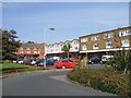
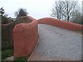
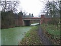

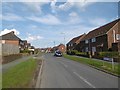
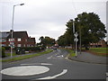
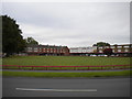
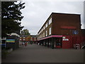
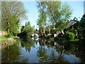
31 photos from this area
Area Information
Key information about the WV11 3TN including its size, population, and administrative classification.
- Area Type
- Postcode
- Area Size
- 1.1 hectares
- Population
- 1423
- Population Density
- 5396 people/km²
House Prices in WV11 3TN
19
Properties
£112,214
Average Sold Price
£53,500
Lowest Price
£170,000
Highest Price
Showing 19 properties
| Address | Type | Beds | Baths | Last Sale Price | Last Sale Date | |
|---|---|---|---|---|---|---|
| 30 Linthouse Lane, Wolverhampton, WV11 3TN | house | - | - | £105,000 | Jun 2025 | |
| 20 Linthouse Lane, Wolverhampton, WV11 3TN | house | - | - | £146,000 | Apr 2021 | |
| 28 Linthouse Lane, Wolverhampton, WV11 3TN | house | - | - | £170,000 | Oct 2020 | |
| 22 Linthouse Lane, Wolverhampton, WV11 3TN | Semi-detached | 3 | 2 | £98,000 | Oct 2016 | |
| 75 Linthouse Lane, Wolverhampton, WV11 3TN | Bungalow | 3 | - | £145,000 | Nov 2014 | |
| 71 Linthouse Lane, Wolverhampton, WV11 3TN | Detached | - | - | £68,000 | Feb 1996 | |
| 65 Linthouse Lane, Wolverhampton, WV11 3TN | Semi-detached | - | - | £53,500 | Jan 1995 | |
| Linthouse Car Centre, Linthouse Lane, Wolverhampton, WV11 3TN | shop | - | - | - | - | |
| 26 Linthouse Lane, Wolverhampton, WV11 3TN | Semi-detached | - | - | - | - | |
| 40 Linthouse Lane, Wolverhampton, WV11 3TN | house | - | - | - | - |
Page 1 of 2
Energy Efficiency in WV11 3TN
Amenities
Schools
| Rank | School | Type | Entry gender | Ages |
|---|
Explore more schools in this area
Go to Schools tabDemographics
Household Size
Two person
most common
Accommodation Type
Houses
most common
Tenure
82
majority
Ethnic Group
White
most common
Religion
N/A
most common
Household Composition
N/A
most common
Age
47
median
Adults (30-64 years)
most common
Household Deprivation
N/A
with no deprivation
NS-SEC
26
in Lower managerial occupations
Explore more demographic insights in this area
Go to Demographics tabPlanning
Planning Constraints
- Flood RiskPremium
- Ramsar Wetland SitesPremium
- Area of Outstanding Natural BeautyPremium
- Protected Nature ReservePremium
- Protected WoodlandPremium